Islands, Mountains, and Sea: The National Parks of Chūgoku and Shikoku
Guideto Japan
Travel- English
- 日本語
- 简体字
- 繁體字
- Français
- Español
- العربية
- Русский
1. Daisen-Oki National Park (Tottori, Shimane, and Okayama Prefectures)
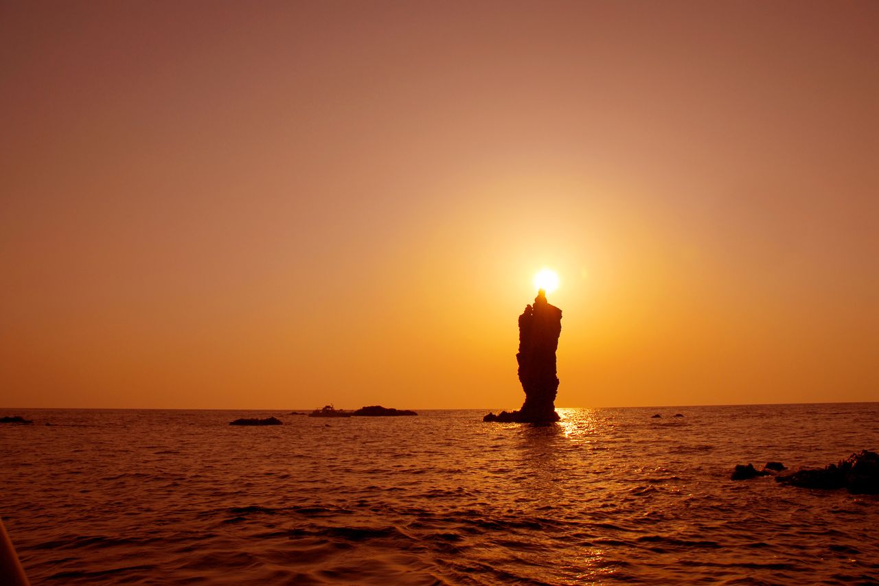
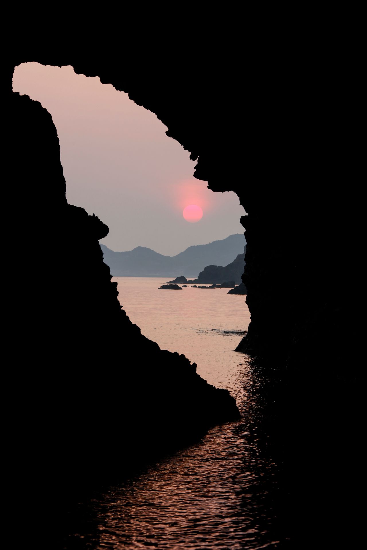
The setting sun appears as a flame atop candle-shaped Rōsokujima off the northwestern tip of Dōgo, one of the islands in the Okinoshima chain. (Courtesy Okinoshima Town Office)
The area around 1,729-meter Mount Daisen was designated a national park in 1936. In 1963, the park was expanded to include Mount Hiruzen, on the border with Okayama Prefecture, and Shimane Prefecture’s Okinoshima, the Shimane Peninsula, and Mount Sanbe, forming Daisen-Oki National Park. It was later further enlarged to add Mount Kenashi and Mount Hōbutsu, in the Daisen-Hiruzen region, and Mount Mitoku and its surroundings. Its attractions include splendid peaks, diverse vegetation, the rugged Sea of Japan coastline, and historic shrines and temples.
In contrast to its craggy northern and southern faces, the graceful silhouette of Mount Daisen viewed from the city of Yonago to the west has earned it the name “Hōki Fuji” after Japan’s most famous peak. Forests of Japanese beech rise midway up its flanks, with colonies of Daisen kyaraboku (Japanese yew), an evergreen shrub designated a natural monument, growing above the elevation of 1,300 meters.
Along with Mount Daisen, the neighboring pinnacles Mount Senjō and Mount Mitoku are traditionally known as the “three peaks of Hōki” (the old name for the province) and are where shugendō ascetic mountain worship has long been practiced. On Mount Mitoku, the Nageiredō Hall, a national treasure, at Buddhist temple Sanbutsuji is especially well known.
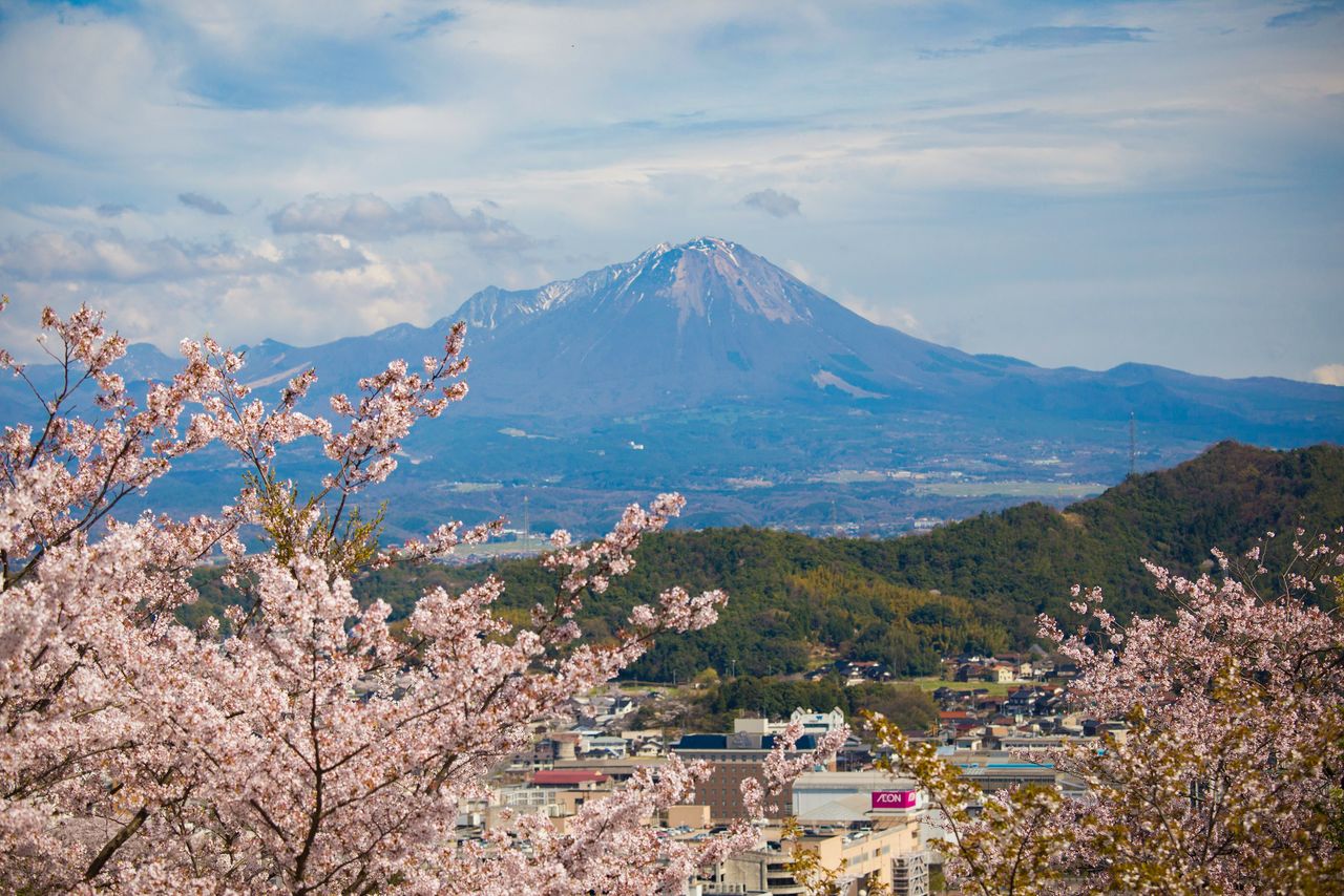
Mount Daisen, viewed from the ruins of Yonago Castle, a site renowned for cherry blossoms. (Courtesy Tottori Prefecture)
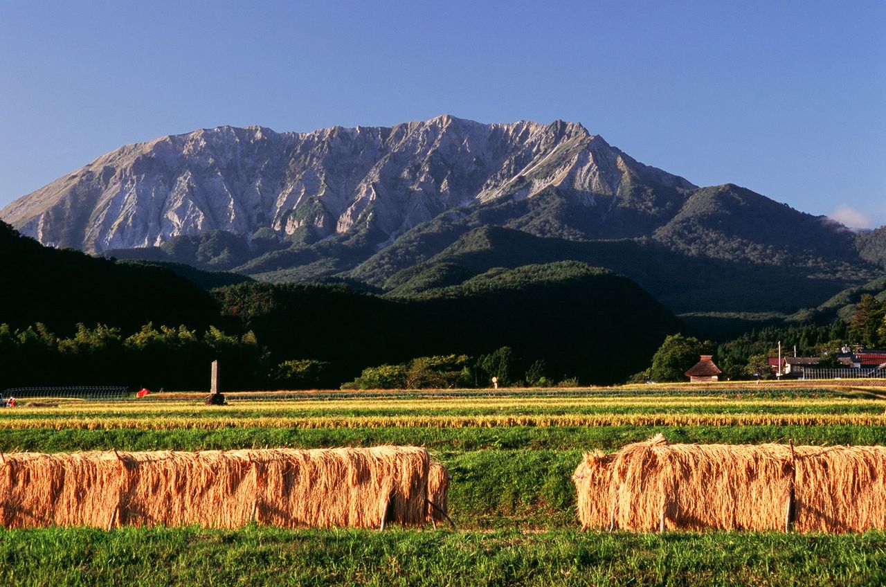
An autumn view of Mount Daisen from the town of Kōfu, with sheaves of rice drying in the fields. (Courtesy Tottori Prefecture)
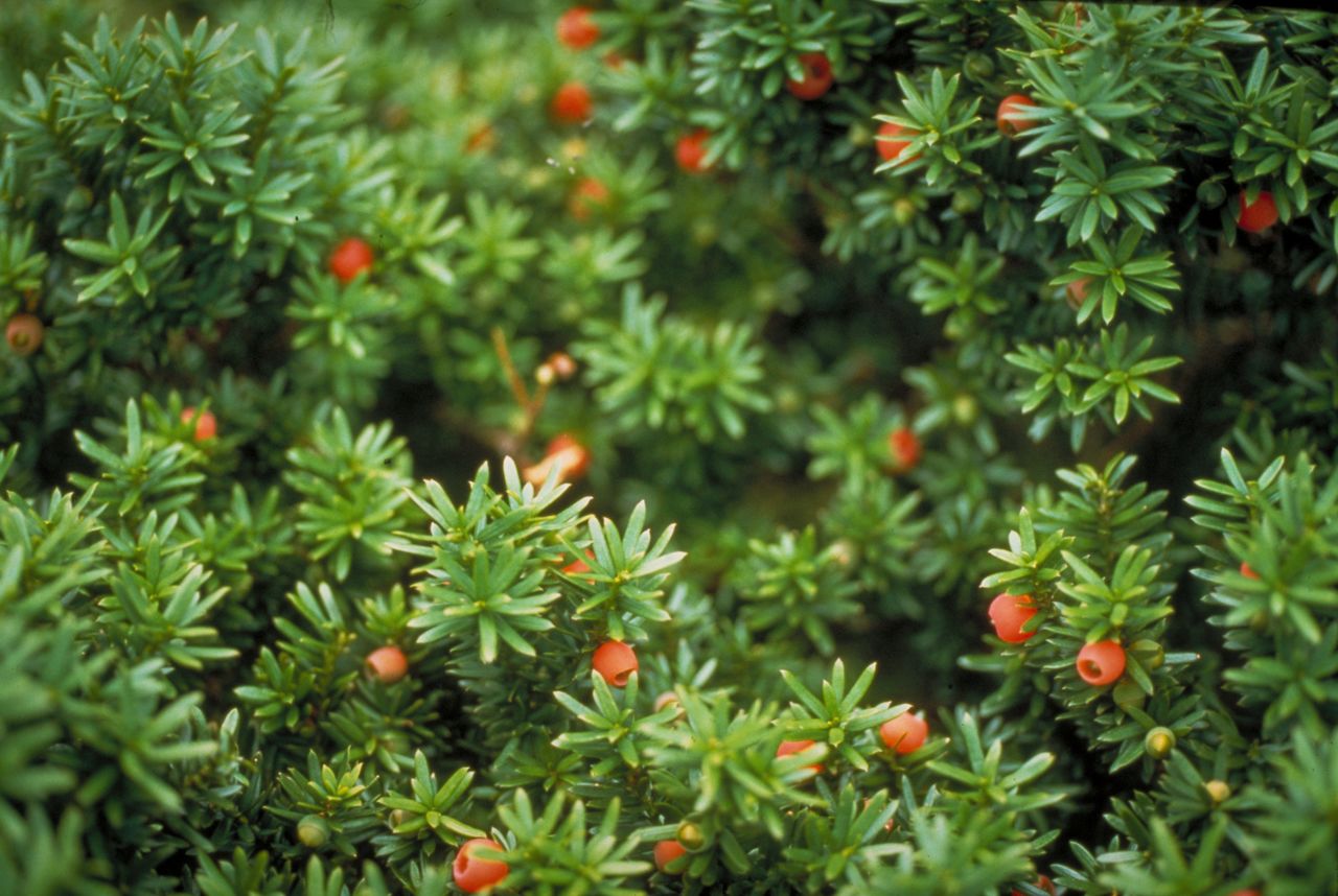
Red berries on Daisen kyaraboku. (Courtesy Tottori Prefecture)
The volcanic plateau at the foot of 616-meter Mount Senjō is where Emperor Go-Daigo (1288–1339) held off forces from the Kamakura Shogunate as he attempted to regain authority. (Courtesy Tottori Prefecture)
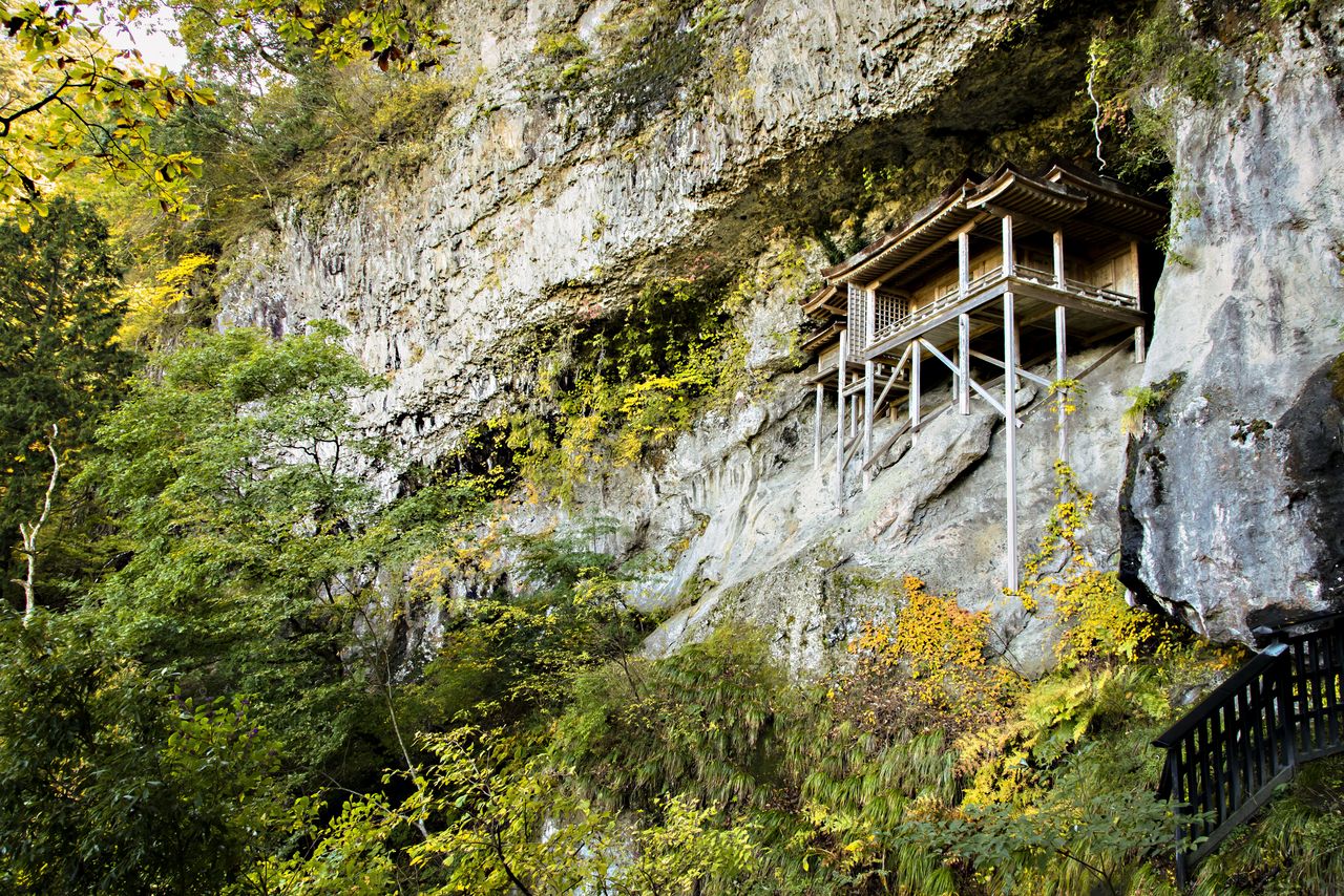
The Nageiredō Hall of Sanbutsuji was erected in the late Heian period (794–1185). Perched at the edge of a cliff, it can be reached only via a narrow, treacherous path. (Courtesy Tottori Prefecture)
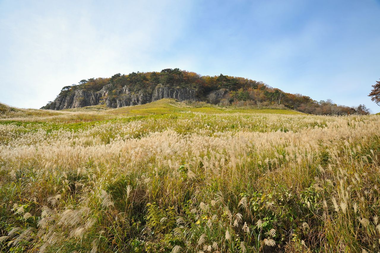
To the east of Mount Daisen, the trio of volcanic peaks that comprise Mount Hiruzen are Kami-Hiruzen (1,202 meters), Naka-Hiruzen (1,125 meters), and Shimo-Hiruzen (1,100 meters). Jersey cattle graze peacefully on the Hiruzen Highlands, 500 to 600 meters above sea level, a popular destination for visitors throughout the year.
The slopes of Mount Kenashi and Mount Sanbe are home to beech forests. The view from Mount Kenashi takes in Mount Daisen and the Hiruzen peaks and stretches all the way to Yumigahama, a picturesque beach on the Sea of Japan. Mount Kenashi’s forests of beech and huge cedars are popular with forest-bathing enthusiasts, and higher up the mountain, colonies of katakuri (dogtooth violets) are in full bloom in early May.
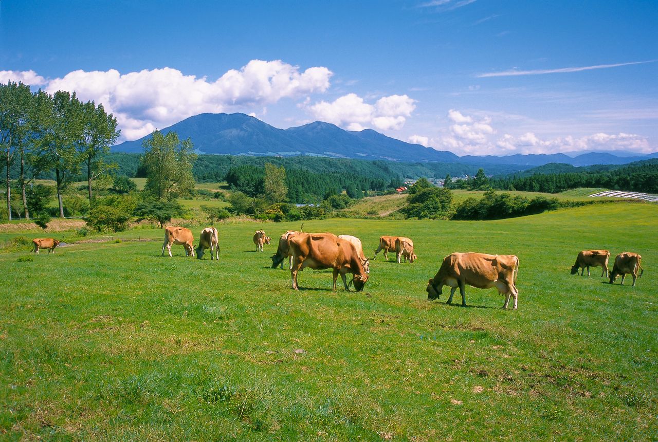
Jersey cattle graze pastures in the Hiruzen Highlands, with the three Hiruzen peaks in the background. (Courtesy Okayama Prefectural Tourism Federation)
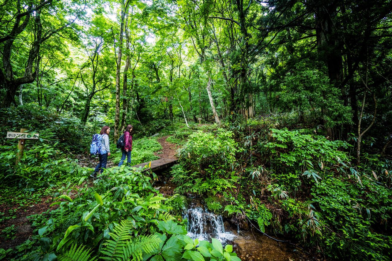
The natural surroundings of the Yurikago Forest Therapy Trail in the southern foothills of Mount Kenashi. (Courtesy Okayama Prefectural Tourism Federation)
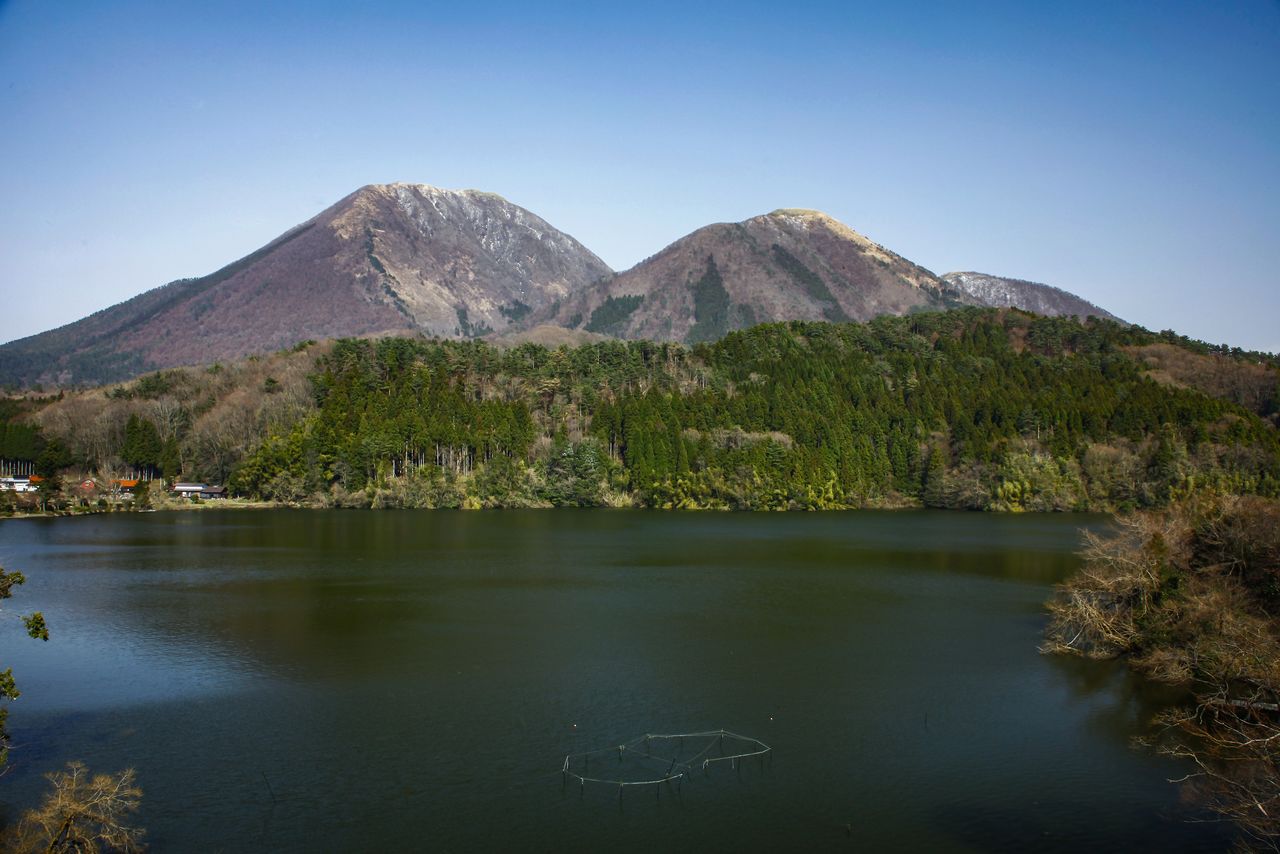
The scenic Ukinuno pond with the peaks of Mount Sanbe in the distance. (Courtesy Shimane Prefectural Tourism Federation)
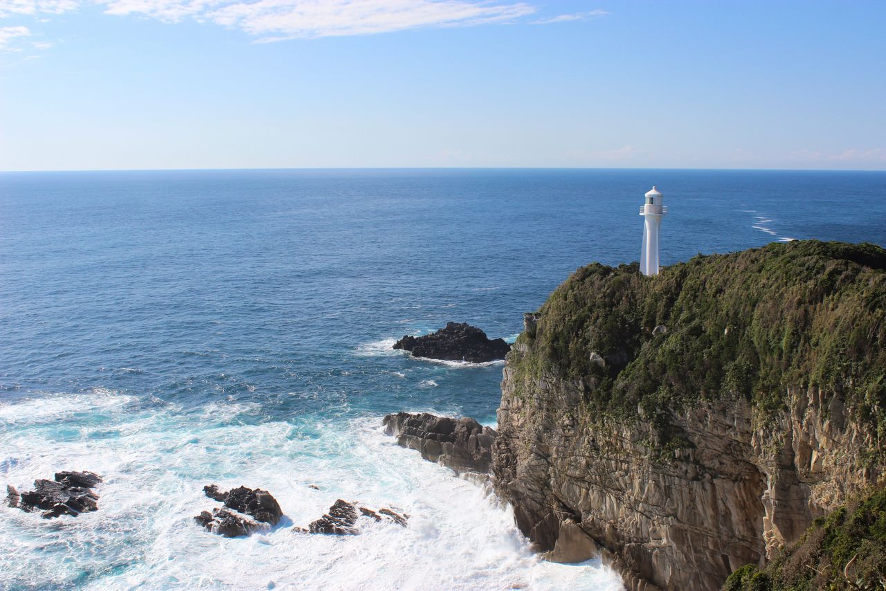
On the north shore of the Shimane Peninsula, the park extends from Hinomisaki at the western tip east to include the area from the Kaka-no-kukedo marine caves to Jizōmisaki. It is home to many Shintō shrines, including Izumo Taisha Shrine, associated with myths connected to the creation of Japan and located in the city of Izumo in the west, and Miho Shrine in Matsue in the east. Scenic spots abound, including the rugged shores of the Sea of Japan and the Hinomisaki lighthouse.
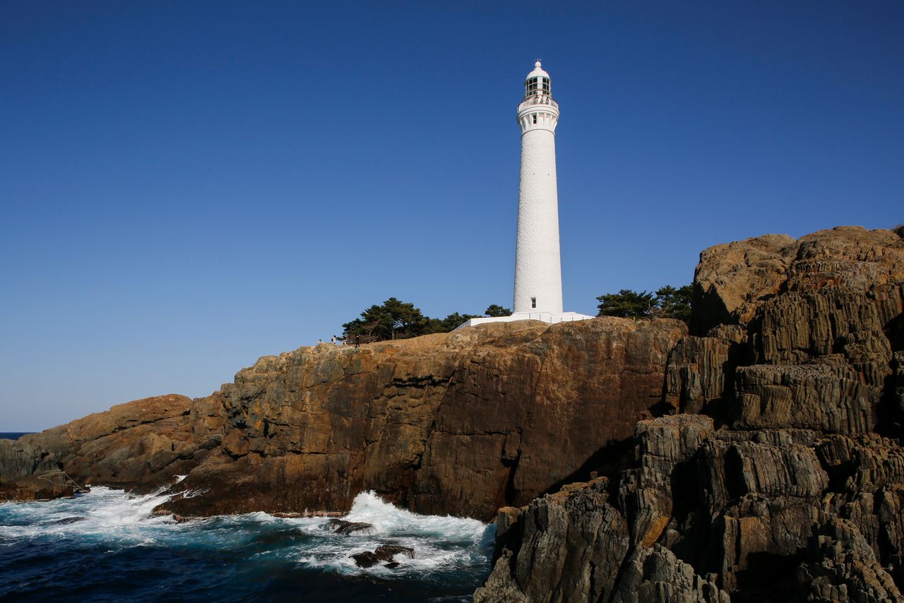
The Hinomisaki lighthouse the western tip of the Shimane Peninsula stands 43.65 meters above sea level, the highest spot for a lighthouse in the country. (Courtesy Shimane Prefectural Tourism Federation)
The two-storied gate of Hishizumi-no-miya, the “sunset shrine.” Attached to the Hinomisaki Shrine, it is considered the protector of the night. (Courtesy Shimane Prefectural Tourism Federation)
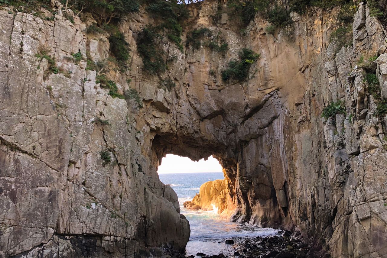
An opening in the cliff face at the Kaka-no-kukedo sea caves, the mythology birthplace of the god Sada-no-ōkami. Designated both a place of scenic beauty and a natural monument, the caves are a favorite spot for visitors viewing the rising sun aboard tour boats. (Courtesy Shimane Prefectural Tourism Federation)
Miho Shrine and its more than 3,000 subsidiary shrines throughout the country are associated with Ebisu, the god of prosperity in business and protector of fishermen and sea journeys. (Courtesy Shimane Prefectural Tourism Federation)
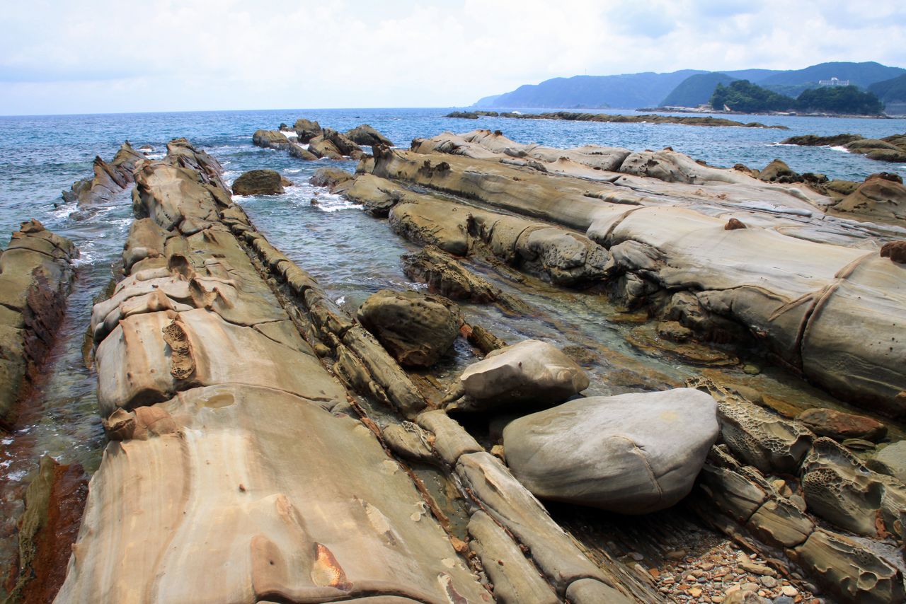
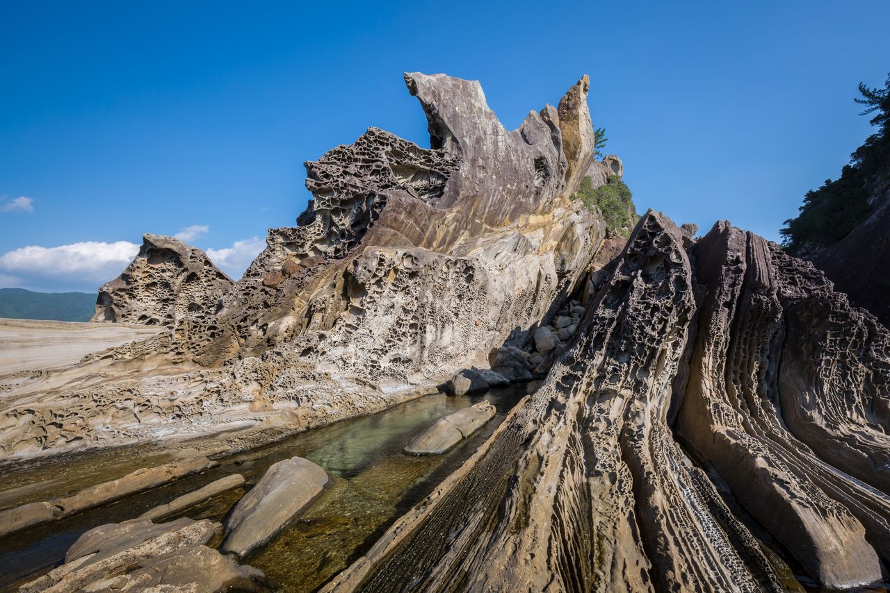
The Okinoshima area consists of over 180 islands of differing sizes stretching north of the Shimane Peninsula. They are divided into two groups: Dōzen to the southwest and Dōgo to the northeast. Natural attractions include the Jōdogaura beach, the Shirashima and Kuniga coasts, and Rōsokujima. The islands are renowned for their flowers, particularly the Oki rhododendron. Mount Daimanji, towering 608 meters over the sea, is famous for its old-growth cedars.
(Date of designation: February 1, 1936. Area: 35,353 ha.)
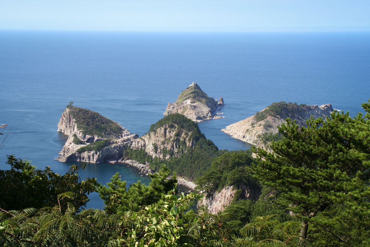
The Shirashima coast, at the northern tip of Dōgo, is a designated scenic area and a natural monument. A panorama of rough-hewn islets and green pines unfolds against the blue waters of the Sea of Japan. (Courtesy Okinoshima Town Office)
The Kuniga coast, on the western side of Dōzen, features sheer cliffs and curious rock formations such as Tsūtenkyō (photo center). (© Pixta)
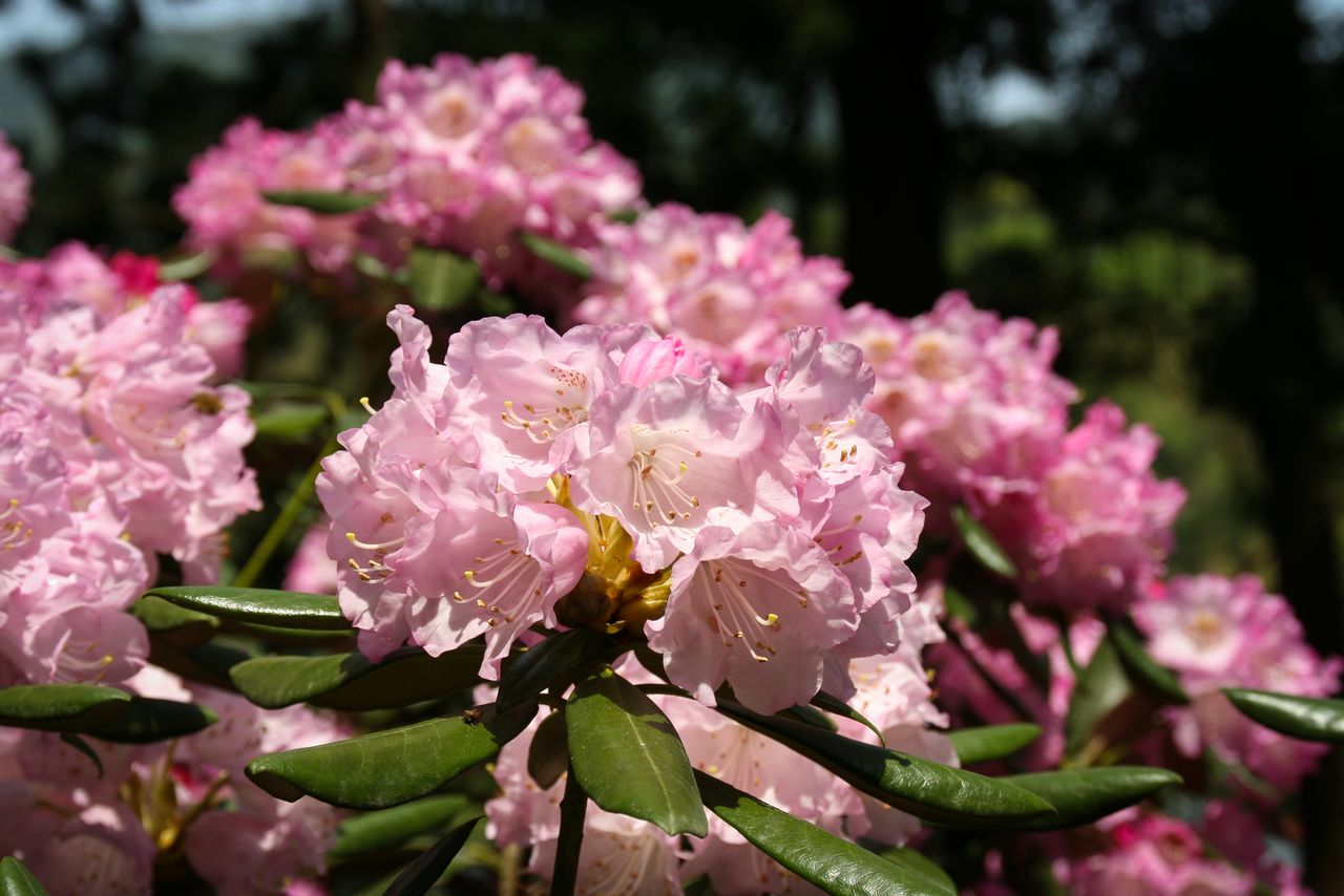
The Oki rhododendron, symbol of Okinoshima, is at its best from late April to mid-May. (Courtesy Okinoshima Town Office)
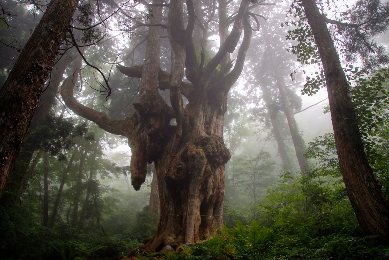
Iwakura no Chichisugi, an 800-year-old cedar with exposed roots, lies in the southern foothills of Mount Daimanji. Thirty meters tall, its root system is 16 meters in circumference. (Courtesy Okinoshima Town Office)
2. Ashizuri-Uwakai National Park (Ehime and Kōchi Prefectures)
The Cape Ashizuri lighthouse, in the city of Tosa-Shimizu at the southernmost point of Shikoku. Groves of wild camellia grow on the cape. (Courtesy Kōchi Visitors and Convention Association)
The park covers the area from Kōchi Prefecture’s Cape Ashizuri, the southernmost point of Shikoku at the southwestern end of the island, to the coastal areas of the Uwakai Sea in Ehime Prefecture. It was created in 1972 by amalgamating the existing Ashizuri Quasi-National Park, established in 1955, with the marine park zones and other coastal areas of the Uwakai Sea. Inland areas include Ehime’s Nametoko Gorge and Mount Sasa.
The eastern part of Cape Ashizuri consists of deeply ridged coastline, with 80-meter-tall cliffs a distinguishing feature of the area. Blessed by the warm Kuroshio current, it is rich in sub-tropical vegetation like Chinese fan palm, ubame oak, and camellias. The sea is filled with beautiful coral reefs and colorful tropical fish.
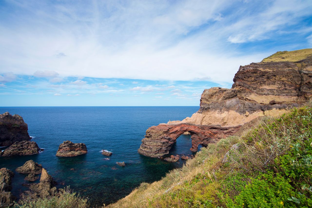
Fifteen kilometers west of Cape Ashizuri, Tatsugushi is a scenic area with interesting rock formations whose raised ridges resemble bamboo. This area is also designated a marine park, and visitors can ride glass-bottomed boats running between Chihiromisaki and Minokoshi for a look at the Cape’s rock formations and the wonders of the underwater world.
Hakusan-dōmon, a rock aperture 400 meters west of the Cape Ashizuri lighthouse, appears heart-shaped when viewed from a certain angle, making it popular among people seeking romance. (Courtesy Kōchi Visitors and Convention Association)
Unusual rock formations are plentiful along the coast at Tatsugushi. The notches on the elongated rocks give them an appearance similar to bamboo. (© Pixta)
A glass-bottomed tour boat sails in front of the Ashizuri Underwater Aquarium. (© Pixta)
Jagged rock formations along the Minokoshi coast are best viewed from tourist boats. (© Pixta)
To the west, the coast consists of headlands, cliffs, and rocky shoals. On the southern coastline at Ōdō, granite cliffs over 100 meters tall are an impressive sight. In addition to the 30-meter sea stack Kannon-iwa, many other notable sights can be observed from lookouts in the area.
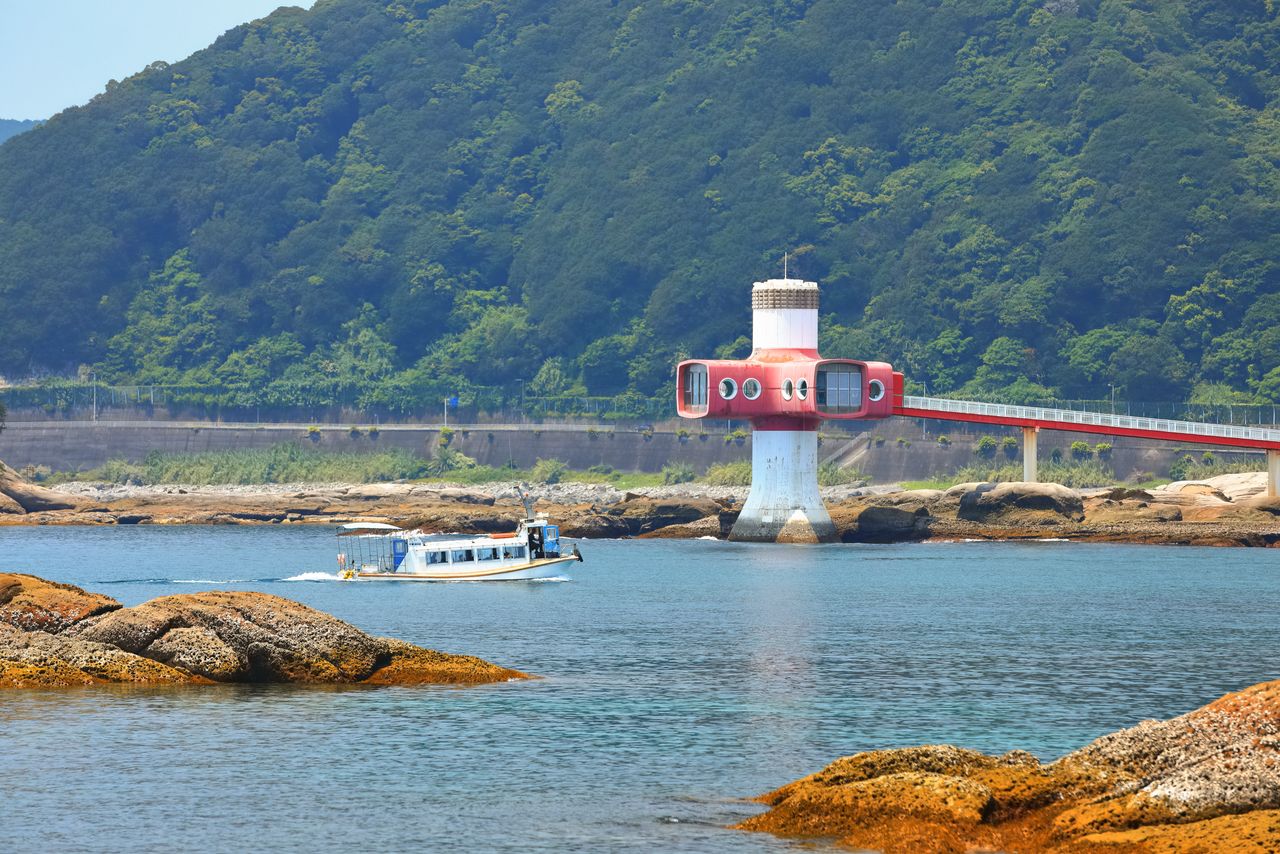
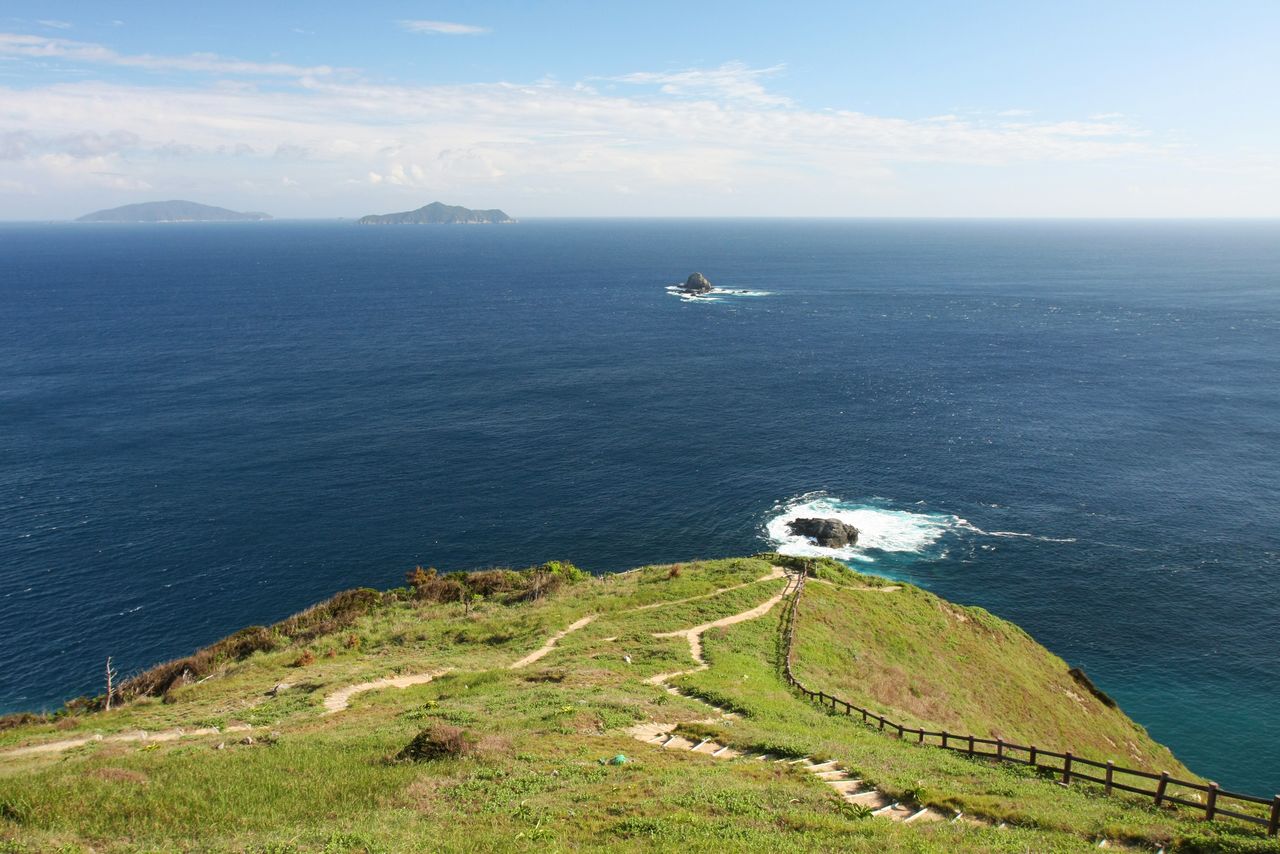
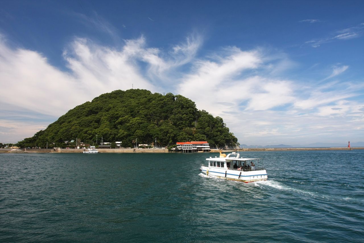
At the tip of the Ōtsuki Peninsula lies Kashiwajima, and five kilometers further offshore to the southwest, Okinoshima. These islands are popular among outdoor types who enjoy diving or fishing.
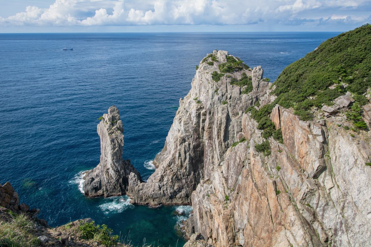
Kannon-iwa stands off the Ōdō cliffs at the tip of the Ōtsuki Peninsula. (© Pixta)
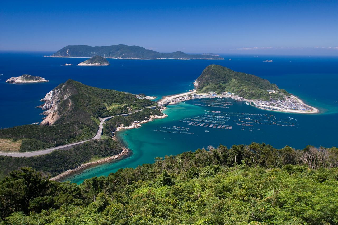
A bridge connects Kashiwajima with the Ōtsuki Peninsula. Okinoshima is visible in the distance. (Courtesy Kōchi Visitors and Convention Association)
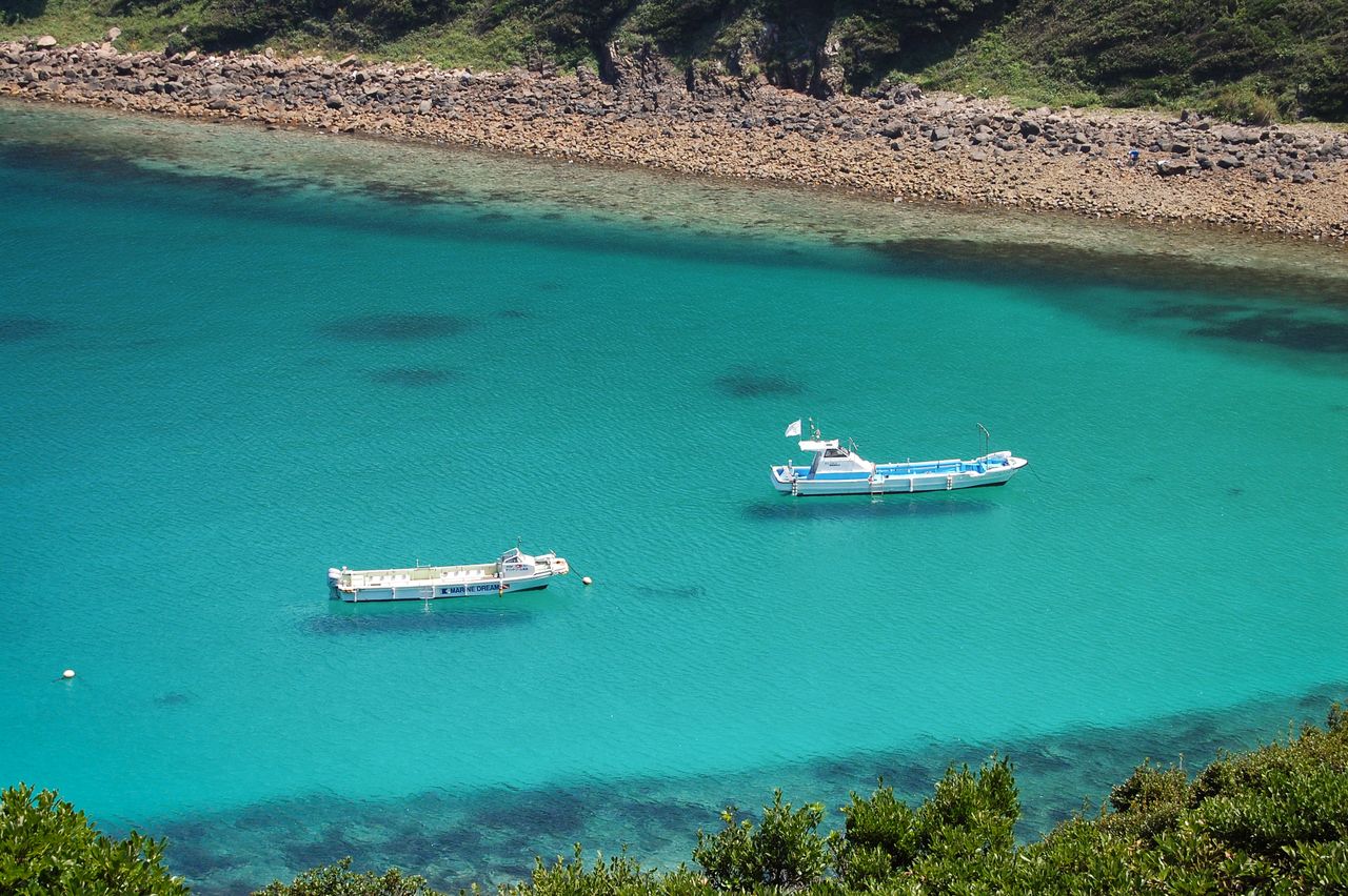
The crystal-clear waters of Kashiwajima gained social media fame with this photo of boats seemingly suspended in space. (Courtesy Kōchi Visitors and Convention Association)
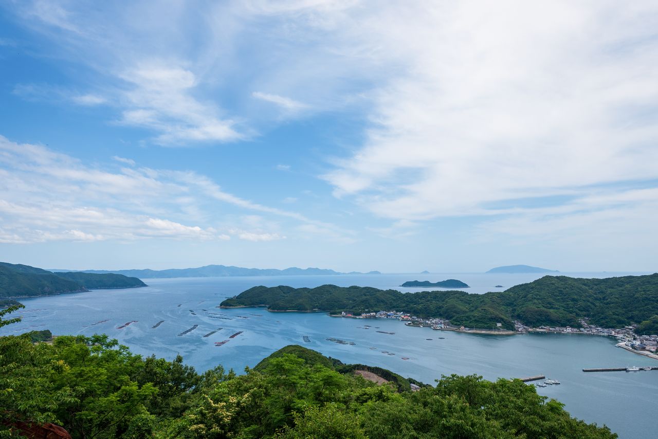
The Uwakai Sea offers a varied panorama of deeply-ridged coastline and islands large and small. The clear waters are home to extensive colonies of soft coral. Beauty abounds in the waters around Kashima, home to wild deer and macaques, where visitors can enjoy snorkeling and other underwater excursions.
The view from the 110-meter-tall Uwa Sea Observation Tower in Ainan, Ehime Prefecture. (© Pixta)
Kōmomisaki, with 100-meter-tall cliffs, is a prime spot for viewing the setting sun. (Courtesy Ehime Local Promotion Association)
Kashima is an uninhabited island 1.5 kilometers around. Venerated in ancient times as the home of the gods, it has several shrines and sites of historical interest. Visitors can enjoy swimming off the beach, snorkeling, and other marine activities, and stay overnight at campgrounds or inns. (Courtesy Ehime Local Promotion Association)
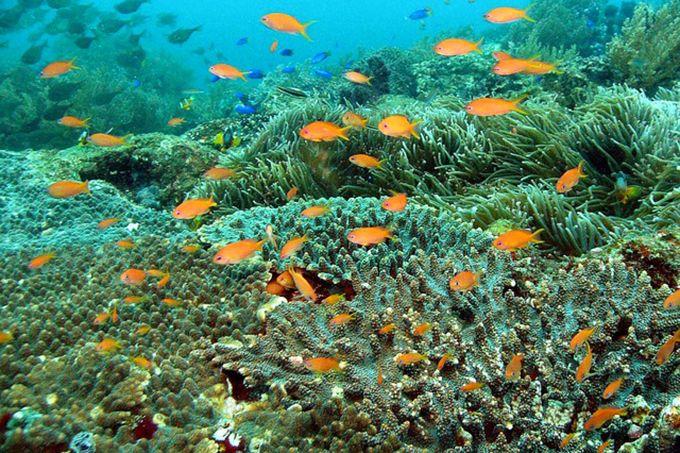
Colorful tropical fish surround the soft coral, called “flowerbeds of the sea,” at the Uwakai Sea Maritime Park. (Courtesy Ministry of the Environment)
Inland, the park’s sights include 1,065-meter Mount Sasa and the Nametoko Gorge up the Shimanto River. Mount Sasa is a sacred spot with Sasayama Shrine near the summit. In spring, climbers flock to the mountain to view Shikoku rhododendron in full bloom. At Nametoko, the waterfalls and the clear waters flowing over massive granite slabs eroded silky-smooth present a unique sight.
(Date of designation: November 10, 1972. Area: 11,345 ha.)
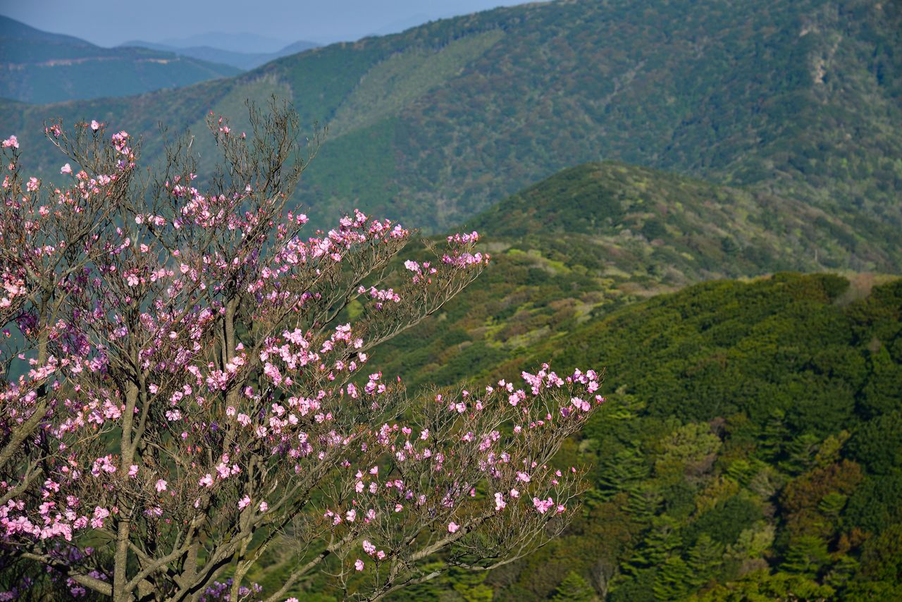
Shikoku rhododendron at the summit of Mount Sasa, with mountain vistas unfolding below. (© Pixta)
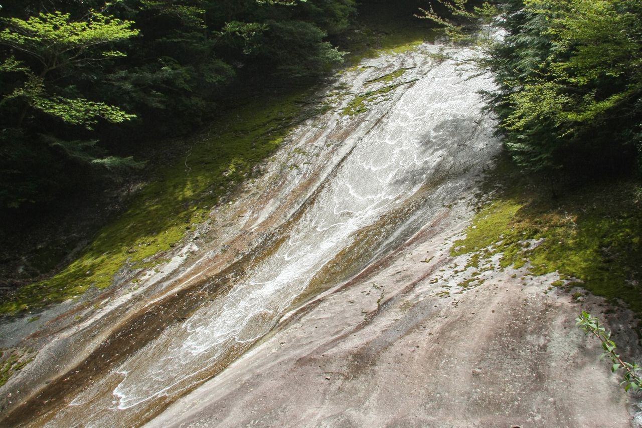
Yukiwa Falls, 20 meters wide and 300 meters long, flows down the smooth rock slabs of Nametoko Gorge. A 12-kilometer-long walking trail runs along the gorge. (Courtesy Ehime Local Promotion Association)
3. Setonaikai National Park (Okayama, Hiroshima, Yamaguchi, Kagawa, Tokushima, and Ehime Prefectures)
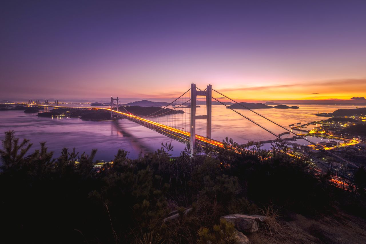
Sunset view of the Seto Ōhashi bridge from Mount Washū in Kurashiki. (Courtesy Okayama Prefecture Tourism Federation)
Setonaikai National Park, Japan’s largest, initially encompassed only Hiroshima, Okayama, and Kagawa Prefectures. It was later expanded to include 11 prefectures bordering the Inland Sea, stretching from Osaka and Wakayama Prefectures in the east to Ōita and Fukuoka in the west. Including the sea portion, the park covers an area of 900,000 hectares.
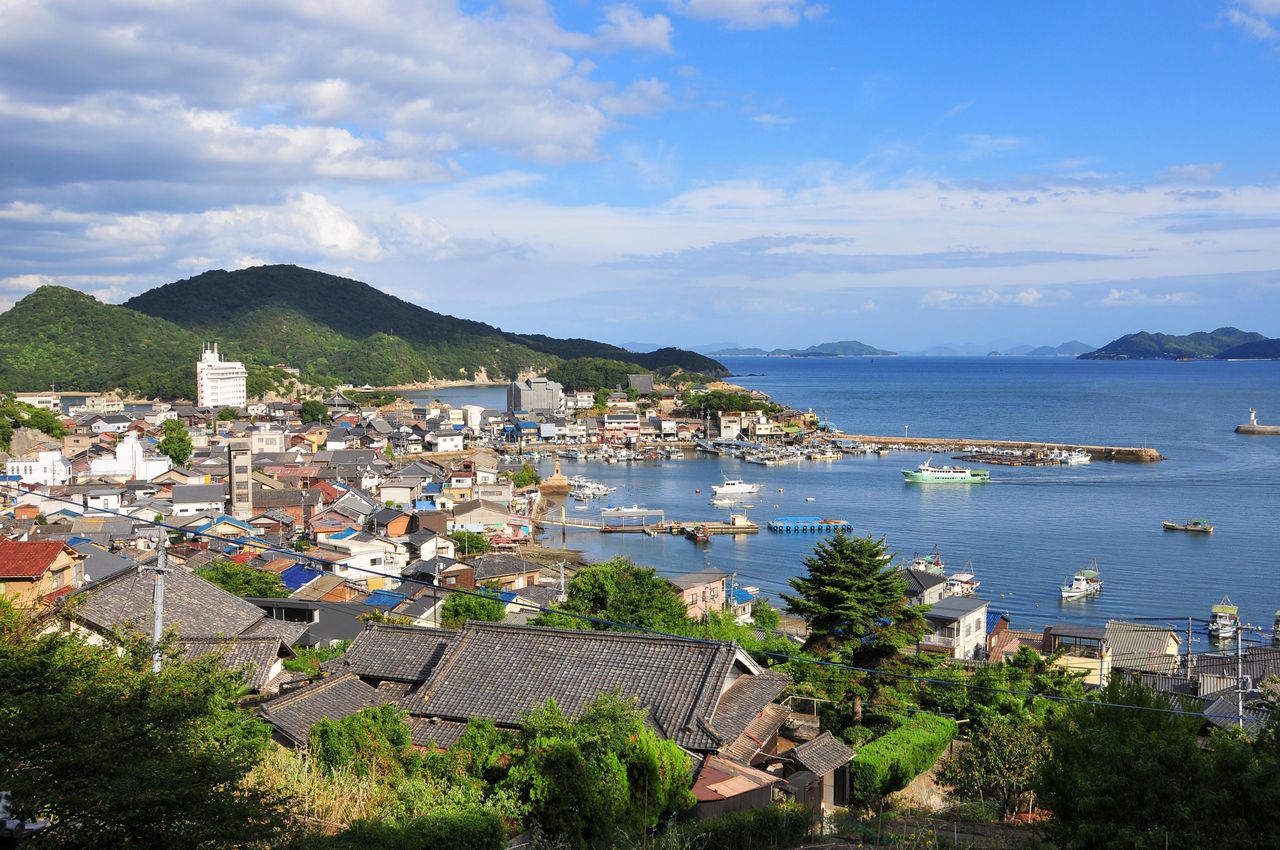
In the Chūgoku region, the Hinase Islands and the pinnacles of Ushimado, Kinkōzan, Ōjigatake, and Mount Washū in Okayama Prefecture are popular with visitors. In Hiroshima Prefecture, choice sites include Tomonoura, Mount Noro, Mount Yasumi, and Miyajima. Farther west, Yamaguchi Prefecture’s Suō-ōshima and the Kanmon Strait beckon.
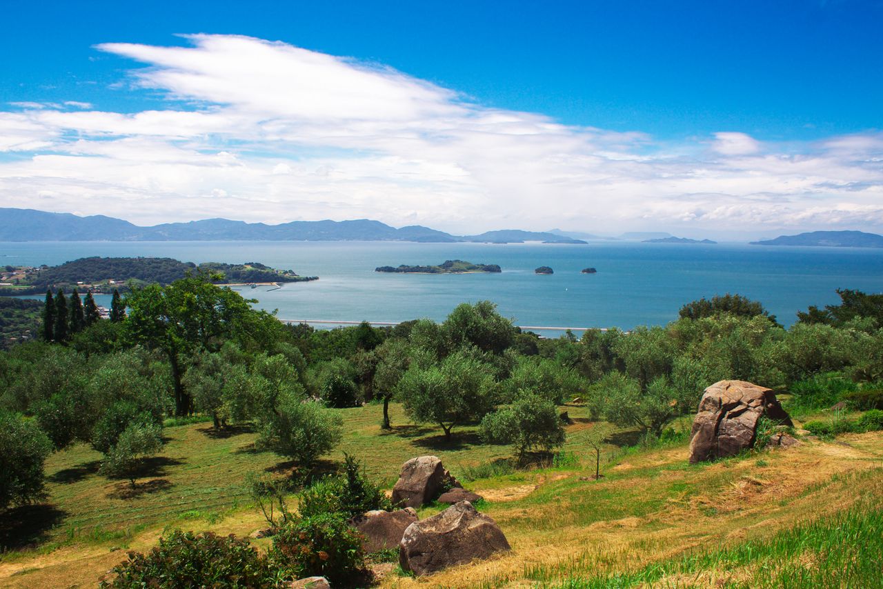
Looking out over the picturesque sea from Ushimado Olive Garden. (Courtesy Okayama Prefecture Tourism Federation)
The historic townscape of Tomonoura, in Fukuyama, is a popular destination known as the locale for Studio Ghibli’s animated film Ponyo. (Courtesy Hiroshima Prefecture)
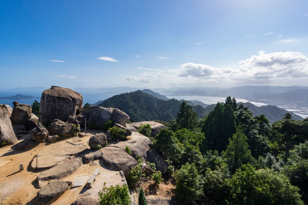
The view from Mount Misen at Miyajima. The path to the top is strewn with gigantic boulders. (© Pixta)
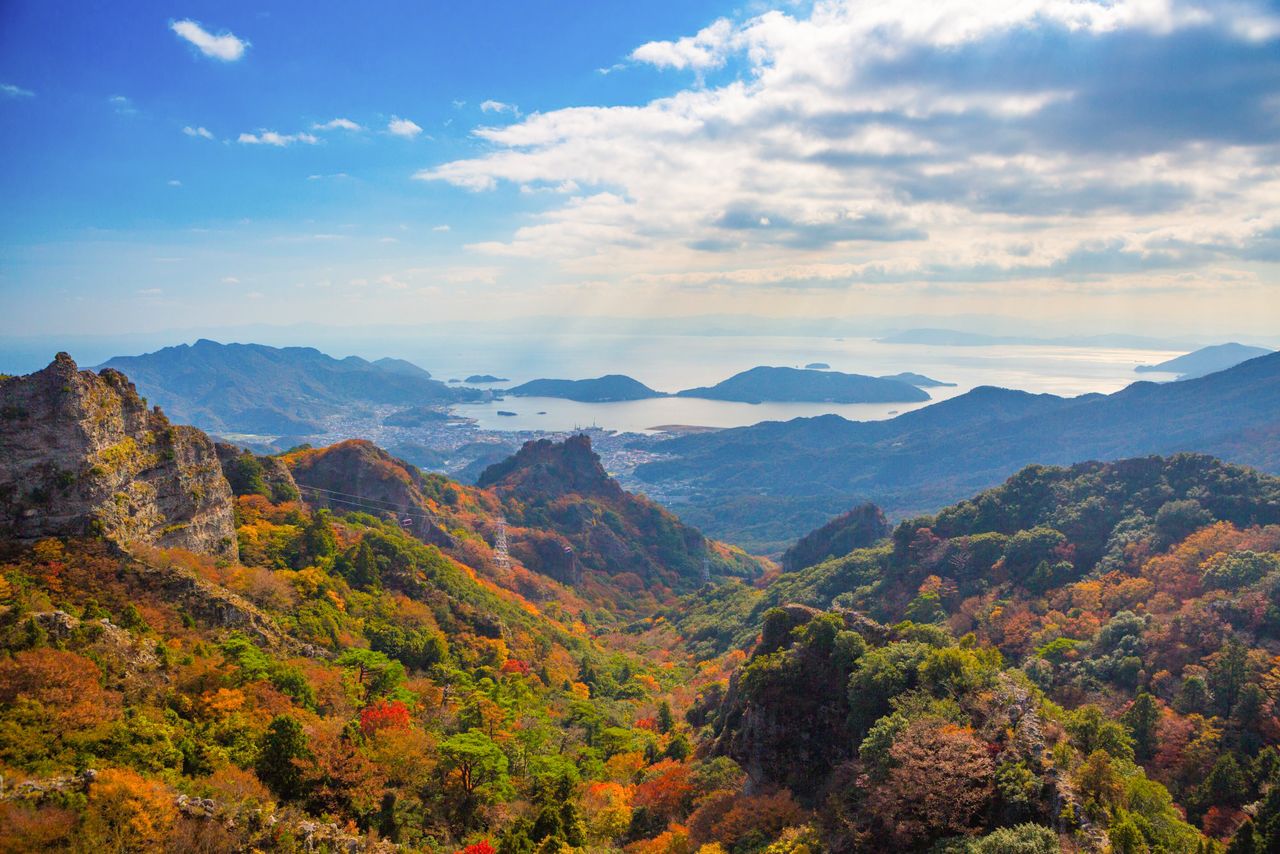
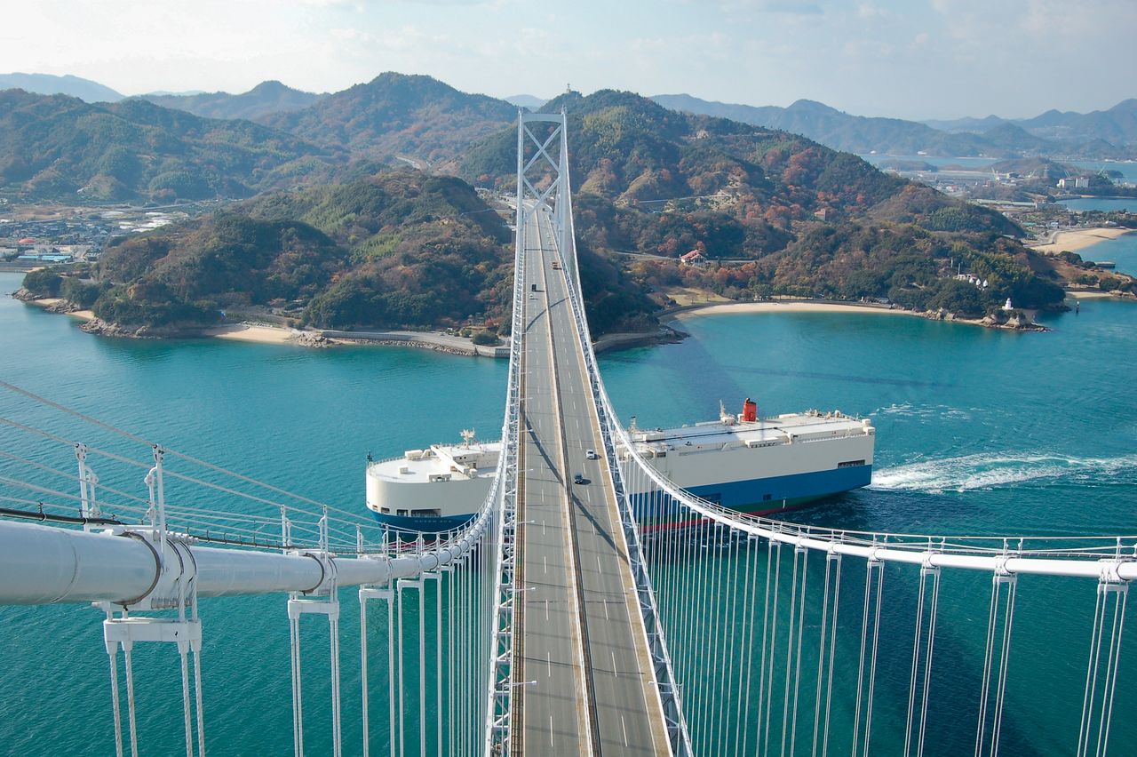
Portions of the park on Shikoku include the Naruto Strait in Tokushima Prefecture and Shōdoshima, the Naoshima Islands, Yashima, and the Goshikidai Plateau in Kagawa Prefecture. Further to the west, Ehime Prefecture’s Cape Sada and the Hōyo Strait are among the many sights in the area. The Shimanami Kaidō linking Hiroshima Prefecture’s Onomichi and Imabari in Ehime Prefecture is also an appealing attraction.
(Date of designation: March 16, 1934. Area: 66,934 ha.)
Kankakei Gorge on Shōdoshima is renowned for vibrant autumn foliage. (Courtesy Kagawa Prefecture Tourism Association)
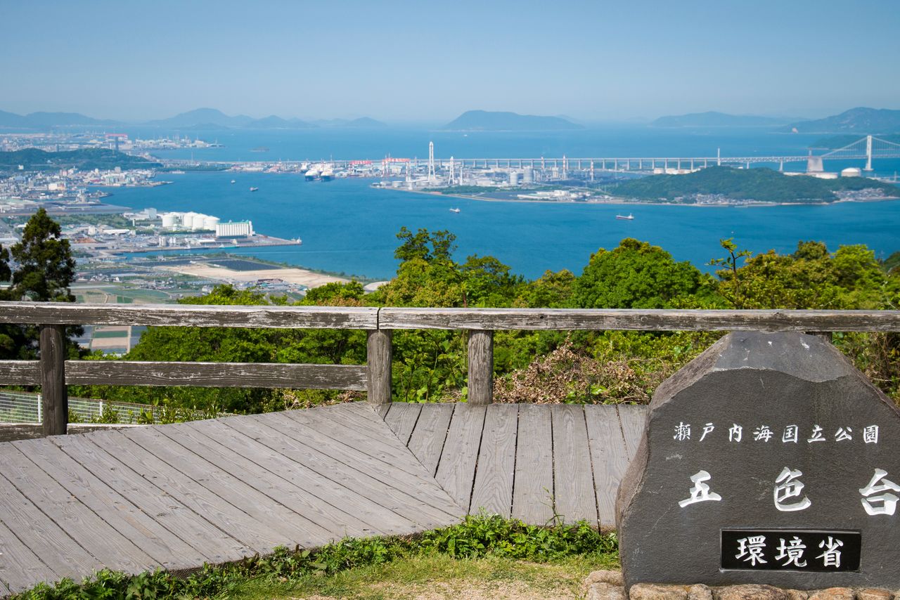
A panorama of islands, seen from the lookout at the Goshikidai Plateau. (© Pixta)
Innoshima Bridge is one of several along the Shimanami Kaidō, a popular cycling route. (Courtesy Okayama Prefectural Tourism Federation)
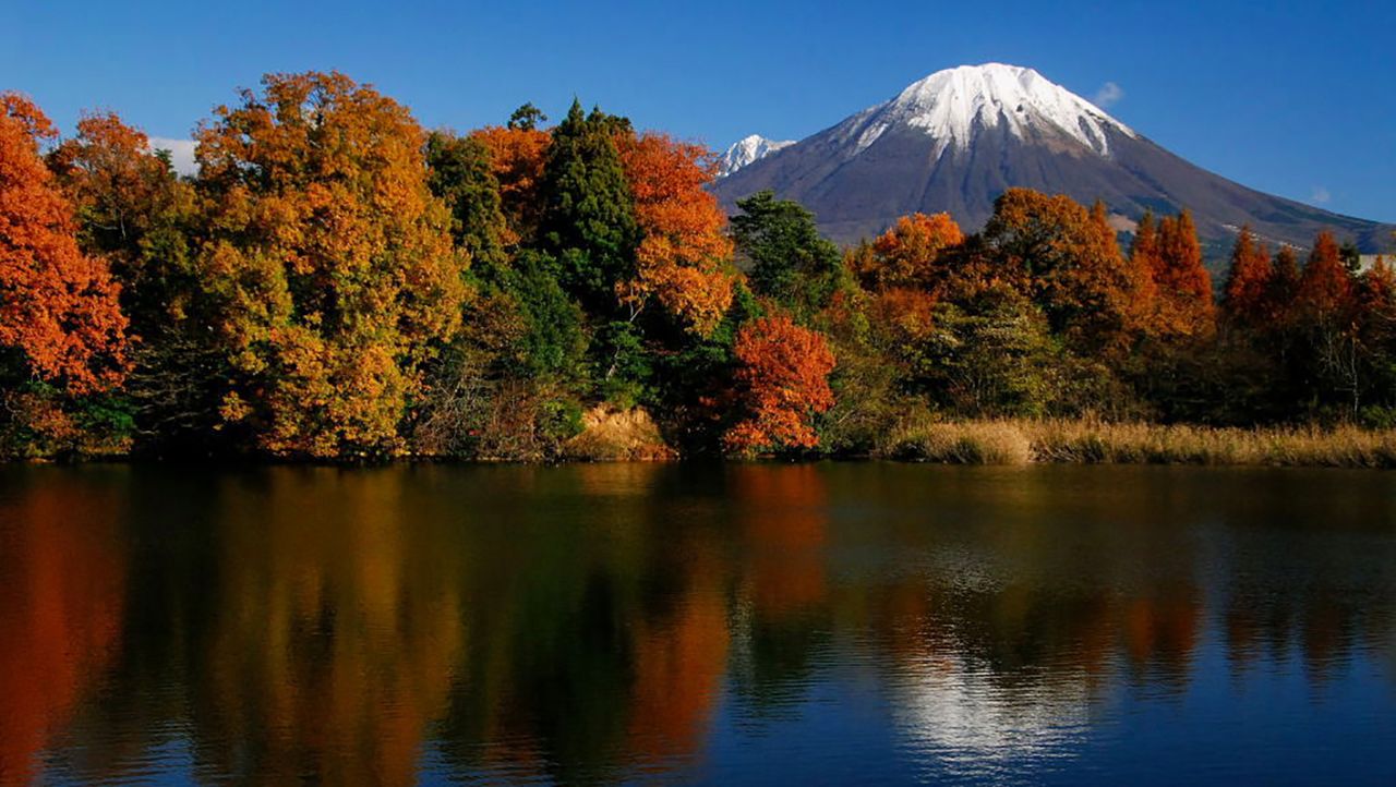
(Originally published in Japanese. Banner photo: Autumn foliage and Mount Daisen. Courtesy Tottori Prefecture.)