The Mount Fuji Research Station: A Scientific Treasure Trove
Science Environment- English
- 日本語
- 简体字
- 繁體字
- Français
- Español
- العربية
- Русский
Famed Mapmakers and Foreign Climbers
Mount Fuji, revered for its beautiful symmetry since the most ancient of times, holds a special place in the hearts and minds of the Japanese people. It is known the world over as a major Japanese icon and is listed as a UNESCO World Heritage site, but few are aware that Mount Fuji has long played a role in important scientific research.
The peak’s scientific significance goes back to the Edo period (1603–1868), around the time Inō Tadataka was setting out to map the entirety of the Japanese islands. Inō launched his project in 1800 and spent the next 17 years surveying the whole country. His completed charts of the archipelago are known today as the “Inō maps.”
To create a precise map, it is important to measure not only horizontal distance but also the azimuth, the angle formed between a reference direction and a line from the observer to a point of interest projected on the same plane. In its isolated majesty, Mount Fuji was a perfect “point of interest” for Inō, as is evident in one of the Inō maps that shows lines radiating from Mount Fuji in all directions. Inō measured Mount Fuji’s height as well, recording it as 3,927.7 meters, only off by 4% from the actual height.
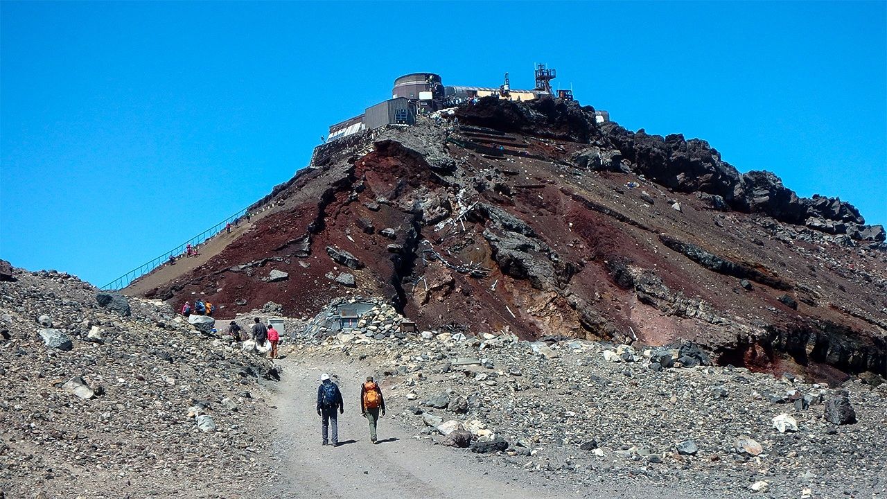
Mount Fuji, soaring in solitary majesty, provides a perfect setting for meteorological observations. (Photo by the author)
Mount Fuji also attracted many of the foreigners who came to Japan in the years just before and after the start of the Meiji era (1868–1912). John Rutherford Alcock, the first British Counsel-General appointed to Japan near the end of the Edo period, became the first foreigner to climb Mount Fuji in 1860. His temperature records taken during the climb are the first meteorological data collected at the peak of the famous volcano. After the Meiji Restoration of 1868, the new Japanese government was eager to modernize the country, and hired a number of foreign experts to accelerate the process. One of these people was the American physicist Thomas Corwin Mendenhall, who climbed Mount Fuji in the summer of 1880 with five Japanese students working under him. Arriving at the summit, Mendenhall used a Kater’s pendulum to measure the gravitational constant and the geomagnetic field. These experiments marked the dawn in Japan of the science of volcanic activity prediction, as the location and condition of the magma inside a volcano can affect gravity and magnetic field measurements there.
The German technician Erwin Knipping was another foreigner who contributed to meteorology in Japan by creating, printing, and distributing daily weather charts. Knipping climbed Mount Fuji in 1887 and took weather measurements at the summit. Led by such foreign experts, the Japanese began to station personnel on Mount Fuji during the summer to make weather observations and record data.
The Intrepid Nonakas
Accurate weather forecasts, however, require regular, long-term observations. Nonaka Itaru aspired to do just that. A student at a university preparatory school (now the College of Arts and Sciences at the University of Tokyo), he dropped out, found a mentor in Wada Yūji at the Central Meteorological Observatory (now the Japan Meteorological Agency), and with instruments and technical advice from Wada, made his way in the summer of 1895 to the Kengamine ridge, the highest point on Mount Fuji’s caldera rim. There he built a small hut of roughly 20 square meters using his own funds. In early October he settled into the hut alone and began taking weather measurements.
Itaru was taking measurements every two hours, day and night. His wife, Chiyoko, feared he would not survive the winter at such a pace. Without his knowledge, she began training so that she could make the arduous ascent to join him at the top of Mount Fuji. Two months later, Chiyoko left their 2-year-old daughter with her parents and followed her husband up the mountain, arriving at his hut unannounced. She brushed aside Itaru’s protests that she should go back down and stayed to work as his assistant. Weather observation in Japan at that time was not nearly as sophisticated as it was in the West. Nevertheless, the Nonakas’ little hut at the top of Mount Fuji became the world’s first mountaintop, all-time weather station.
Winter at the summit of Mount Fuji is grueling. When supporters visited the couple in early December, the temperatures were below –20º Celsius. They found Itaru and Chiyoko malnourished and suffering from altitude sickness. Shocked that the two intended to stay and continue their work, the supporters forced them down the mountain on December 22. Having persevered for just under three months, it was with great disappointment that the two gave up their dream to continue the weather observations through the winter. Still, their attempt to do something no one else in the world had ever undertaken was enough to stir great excitement throughout the country.
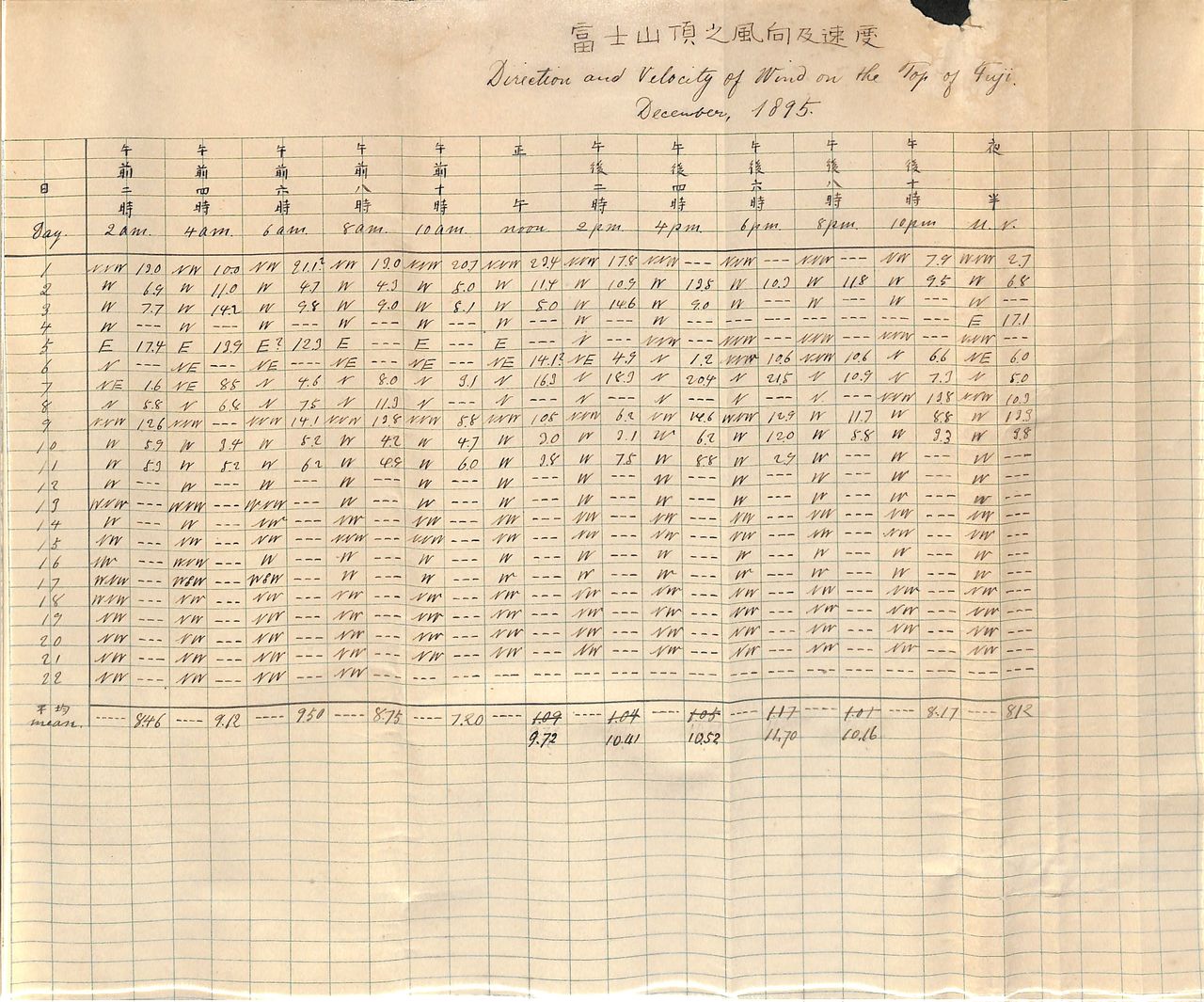
Weather readings made by Nonaka Itaru and Chiyoko. The last reading is for December 22, 1895, when they were compelled to leave the summit. (Photo courtesy of the Nonaka Itaru and Chiyoko Digital Archive. The original document belongs to their grandson, Nonaka Masaru.)
A New Observatory and a Role in Typhoon Detection
Prince Yamashina Kikumaro, a member of a collateral line of the Japanese imperial family with a keen interest in meteorology, used his personal funds in 1902 to build a weather observatory on Mount Tsukuba. The site is today home to the Meteorological Station of the Mt. Tsukuba Shrine & Center for Computational Sciences, University of Tsukuba.
In 1927, Satō Jun’ichi, who managed Prince Kikumaro’s Mount Tsukuba weather station for 20 years, built a small observatory hut on Mount Fuji with funding provided by Suzuki Yasuji, the head of a driving school in Tokyo and formerly the prince’s personal driver. Satō ascended Mount Fuji with the help of a local gōriki, or mountain porter, named Kaji Fusakichi and stayed at what was dubbed the “Satō Hut” for roughly one month, in January and February 1930, to make daily weather measurements. This second attempt at midwinter weather observation at the summit came 35 years after the rash but brave exploits of the Nonakas.
Like his predecessors, Satō underwent great hardship in the cruel winter landscape atop Mount Fuji, falling down a steep slope and suffering through beriberi and severe frostbite. His passion and dedication, however, won him great public respect. In 1932, the Satō Hut was commissioned by the Central Meteorological Office as a provisional Mount Fuji observatory for implementing year-round weather measurements. The commissioning was budgeted for only one year in commemoration of the Second International Polar Year (1932–33), later named International Geophysical Year, but thanks to the entreaties of young meteorologists who offered to work without pay and generous funding from the Mitsui Hōonkai, a philanthropic foundation of the Mitsui enterprise group, the observatory continued to function.
Following these individual efforts, the Japanese government in 1935 decided to include funds for meteorological observation in the regular budget of the Ministry of Education. In 1936, “provisional” was removed from the name, making it the Mount Fuji Observatory of the Central Meteorological Observatory. In the war years that ensued thereafter, the observatory suffered wartime air raids and the loss of personnel, but it somehow persevered, and by 1950 was well known among the general public as simply the Mount Fuji Weather Station.
Japan’s highest peak has also been known to serve as a typhoon watchtower. After the Isewan Typhoon (Typhoon Vera) of 1959 took the lives of more than 5,000 people, the government decided to set up a radar system at the summit of Mount Fuji for the early detection of future typhoons. Construction began in June 1963 and was completed in October 1964. Throughout, workers battled with altitude sickness and frequent lightning strikes. For a long time, the Mount Fuji Radar System was the world’s highest weather radar station and had the longest range, detecting typhoons up to 800 kilometers away. The system’s accuracy, along with updated prediction technology, disaster prevention measures, and information transmission, contributed to major improvements and dramatically reduced the number of typhoon victims.
Saved from Demolition
With the launch of the first Himawari geostationary meteorological satellite in 1977, typhoon monitoring switched from ground-based radar to orbiting observatories. The Mount Fuji Radar System was closed down in 1999, and its landmark white dome was dismantled and removed in 2001.
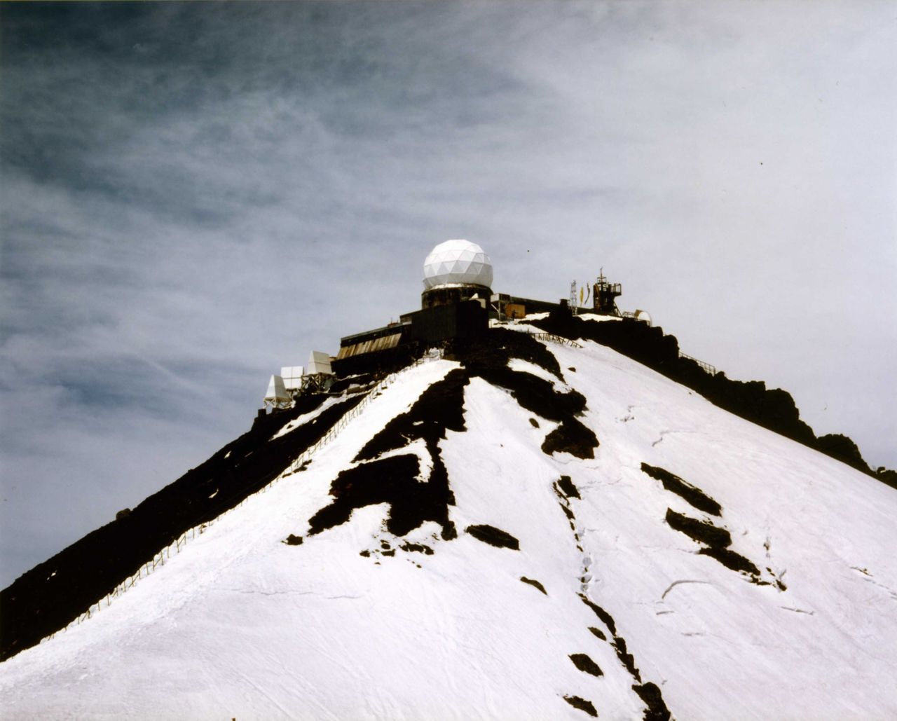
The radar dome before it was removed in 2001. The structure can be seen today at the Mount Fuji Radar Dome Museum in Fujiyoshida, Yamanashi Prefecture. (Photo by Iwazaki Hiroshi, MFRS summit team leader)
With the proliferation of weather satellites and land-based weather radars, manned weather stations were no longer necessary. In October 2004, the Mount Fuji Weather Station was closed, bringing an end to 72 years of continuous manned weather observation. Today, the Japan Meteorological Agency depends primarily on AMeDAS, its unmanned Automated Meteorological Data Acquisition System.
Plans to dismantle the weather station were considered, but a group of researchers anxious to preserve the legacy of scientific mountain observation set up a nonprofit organization in 2007 to lease the observatory and use it for a variety of research activities. The observatory is now known as the Mount Fuji Research Station and is maintained by the nonprofit organization of the same name. The MFRS covers all maintenance costs of the facility, including electricity. The station is open for educational and research purposes for only two months each summer.
Researchers apply to use the station facilities, and have carried out manned projects there every summer since 2007. In the station’s thirteenth season, in 2019, there were 42 research projects in progress. By 2019, an aggregate total of more than 5,000 people had used the station since it was leased by MFRS in 2007. Users include research teams from universities and national institutions as well as private corporations and nonprofessional scientists.
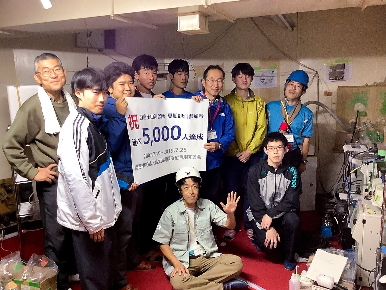
Researchers of all ages and affiliations gather at the station for two months every summer. By its thirteenth year (2019), the aggregate number of users had exceeded 5,000. (Photo by the author)
The MFRS was originally set up to provide the infrastructure of the old observatory to the research community, but today it functions to bring together researchers from diverse fields. It has become a unique organization involved not only in basic and applied research, but in education as well.
Precious Data, but a Struggle for Funding
The data on greenhouse gas emissions collected by Japan’s National Institute for Environmental Studies at the Mount Fuji Research Station is among the most valuable in the world. The mountain’s summit extends into the free troposphere, the layer of the atmosphere above 1,500 meters in altitude where air currents meet little resistance from landforms. This makes it an ideal location for observing and measuring atmospheric pollution. Additionally, because it is reliably exposed to westerly winds, Mount Fuji provides a perch from which to monitor atmospheric conditions throughout East Asia. Long years of data collection here have made it possible, for example, to analyze the effects of Chinese industry and Indonesia’s slash-and-burn farming on atmospheric pollution in the region. Data collection by aircraft is also possible, of course, but nothing is better than a stationary observatory for monitoring continuously changing data. Batteries and solar panels that are maintained by the researchers during the summer allow access to year-round data.
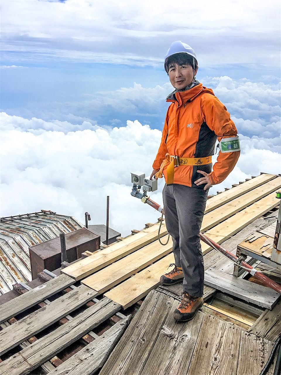
Japan’s highest live webcam can be accessed in the summer. It provides valuable data on cloud formations. As can be seen here, maintaining the station facilities is an important MFRS activity. (Photo provided by the author)
Data collection at the station is also proving invaluable for research on acid rain and PM 2.5 fine particulate matter. Many other kinds of research are conducted at the station, including studies on high-altitude medicine, physical training, lightning, cosmic rays, astronomy, and telecommunications.
Despite Mount Fuji’s status as a UNESCO World Heritage site, despite the fact that many of the station users are researchers from national institutions, and despite the very significant research that is being carried out, the MFRS struggles to get the funding it needs. Its annual operation costs of around ¥45 million are covered by user fees, donations, and competitive research funds. There is no public funding or government subsidy. Fundraising is a continuous scramble, and the MFRS relies heavily on the goodwill of many people. Not a few researchers pay out-of-pocket for their own expenses. Even so, there never seems to be enough money.
Everyone involved with the station, however, feels strongly that they cannot betray the dedication of those who came before them, the intrepid individuals who believed passionately in the scientific value of Mount Fuji and who worked so hard and so long to achieve their research objectives. The MFRS is working hard to inform people and build awareness of the treasure trove Mount Fuji provides for scientific research on the environmental problems confronting the world.
(Originally written in Japanese. Banner photo: The Mount Fuji Research Station at the summit of Mount Fuji. Photo provided by the author.)