Mapping a Wartime Past in Paradise: Interactive Chart Shows Japanese Relics on Tonoas, Chuuk
History- English
- 日本語
- 简体字
- 繁體字
- Français
- Español
- العربية
- Русский
Exploring a Prewar Japanese Presence
A Japanese academic is helping to shed new light on the prewar colonization by Japan of a remote central Pacific archipelago and to map historical sites that remain to this day, more than a century after Chuuk became a critical outpost of the empire.
Ishii Hiroshi, who specializes in maritime archaeology and modern conflict archaeology, has collaborated with an Australian professor of anthropology at the University of Guam to publish a map showing the key historical sites on the island of Tonoas, in the Federated States of Micronesia’s Chuuk state, and a complementary interactive website.
The project is highlighting locations across the 9-square-kilometer island that are frequently overlooked by visitors to Chuuk, which is best known for its underwater attractions.
The lagoon—around 5,250 kilometers southwest of Hawaii—was the site of the Imperial Japanese Navy’s main base in the central Pacific during World War II, but was the target of a two-day attack by US carrier-based aircraft in February 1944 known as Operation Hailstone.
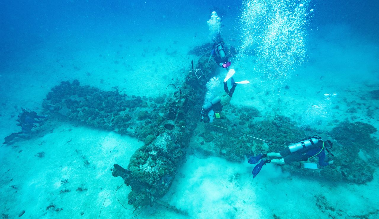
An Aichi E13A float plane sunk during World War II is among the attractions for divers who flock to Chuuk’s waters. (© Julian Ryall)
Over the course of the raid, more than 50 Japanese ships—including warships, cargo vessels and even a submarine—were sunk. Scuba diving of the remarkably well-preserved wrecks began after the famed underwater explorer Jacques Cousteau filmed a documentary about the fabled “ghost fleet” in 1969 and, more than half a century later, the wrecks are still the reason most people visit.
Mapping the History On Shore
By charting the history that is above the waves, Ishii hopes to share more about the Japanese community that lived on what is today Tonoas, but was referred to as Dublon during the Spanish occupation of the islands in the late nineteenth century before becoming Natsushima—or “Summer Island”—when the Japanese took control of the archipelago from Germany in October 1914.
“I am fascinated by an area and a period that are less well-known in Japan, despite the fact that prewar Japanese were heavily invested in these islands,” says Ishii, a researcher at the Center for Southeast Asian Studies at Kyoto University.
Ishii first visited Chuuk in December 2019 to take part in a maritime archaeology field expedition and met Bill Jeffery, of the University of Guam, with whom he has since collaborated on surveys of historic Japanese sites, both on the seabed and on Tonoas.
“The remnants of the years of the Japanese occupation have survived better on Tonoas than elsewhere in Chuuk state primarily because the capital functions of the state were moved to Weno island after Japan’s surrender,” Ishii tells Nippon.com. “And even now, we still do not know how many sites related to Japan’s decades of control of Chuuk remain on other islands in the lagoon.”
Today, the only way to reach Tonoas is by boat, with the crossing from Weno taking about 20 minutes. The island is largely covered in thick jungle and fringed with mangrove swamps, rising to two high hills at the western end, Tonomwan and Tonofefan.
The main sites of historic interest can be accessed via the unpaved tracks that crisscross the island. Dublon Town was clustered around a small inlet on the south side of the island and was a bustling community of around 800 Japanese inhabitants during the prewar years, with an outdoor movie theater, the offices of the Japanese-language newspaper, cafés, and much of the infrastructure that could be found in a small town in Japan.
The area was targeted during the US attacks and most of the buildings were destroyed, with little remaining today. Farther along the coast to the west is the seaplane base, which was again heavily bombed, with the shell of the power plant building and a large underground bunker designed to store aircraft slightly inland.
Hospitals, Schools, and More
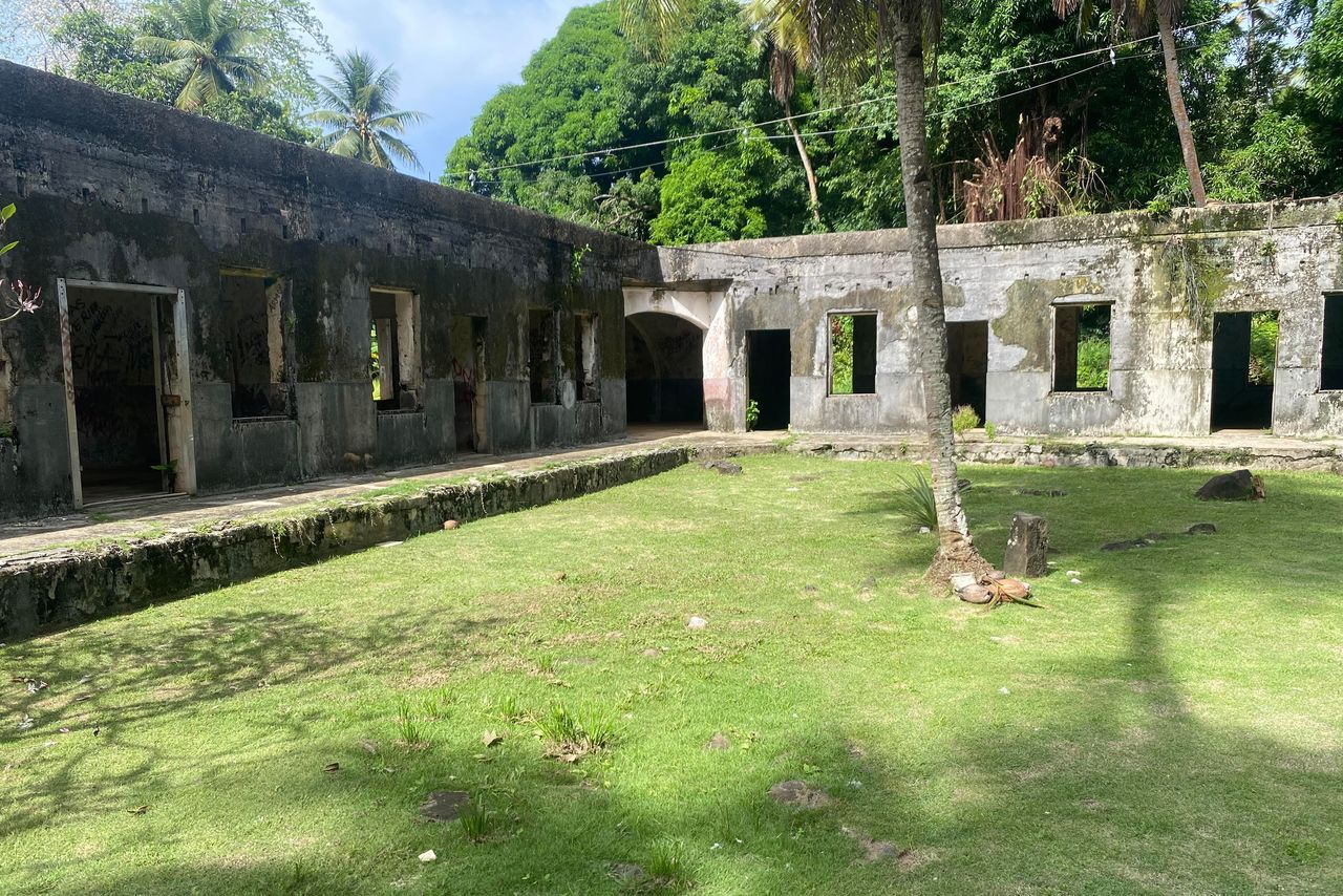
The courtyard of the Tonoas hospital. (© Julian Ryall)
Surrounded by thick undergrowth in the hills above Dublon Town is the shell of a hospital built in 1928, the only one in Chuuk that was open to local people. After war broke out, the Japanese occupying forces used it to treat wounded or ill service personnel.
The main buildings are of concrete and have survived remarkably well. Wards are laid out neatly and there is a spacious grassed area in the center. Knee-high pillars and steps along one side indicate where elevated wooden wards once stood. The floor of one room—possibly used for operations—remains tiled, and the original garden still contains native Japanese plants.
A few hundred meters away is a school built by the Japanese for Chuukese children, although it later served as the local headquarters for the Japanese Territorial Government for the South Seas. Nearby is a stone memorial to businessman and adventurer Mori Koben—still a common family name among Chuukese—who arrived in the islands in 1891 and built a trading empire.
The island’s current elementary school stands on the site of the Japanese military communications center, with stone pillars still upright at the entrance and the concrete bases of radio antennas dotted amid the undergrowth. A reinforced air raid bunker is also within the grounds of the school, with the Japanese moving their communications equipment to a larger tunnel burrowed into a nearby hillside after the 1944 air raids.
The site is historically significant as it was from here in April 1943 that a message was sent providing the details of Admiral Yamamoto Isoroku’s inspection tour of military facilities throughout the South Pacific. Unbeknown to the Japanese, the US had cracked the military code. On April 18, 16 P-38 lightning fighters intercepted Yamamoto’s aircraft and its escort of six Zero fighters over the Solomon Islands. Yamamoto, widely regarded as one of imperial Japan’s most capable military leaders, was killed.
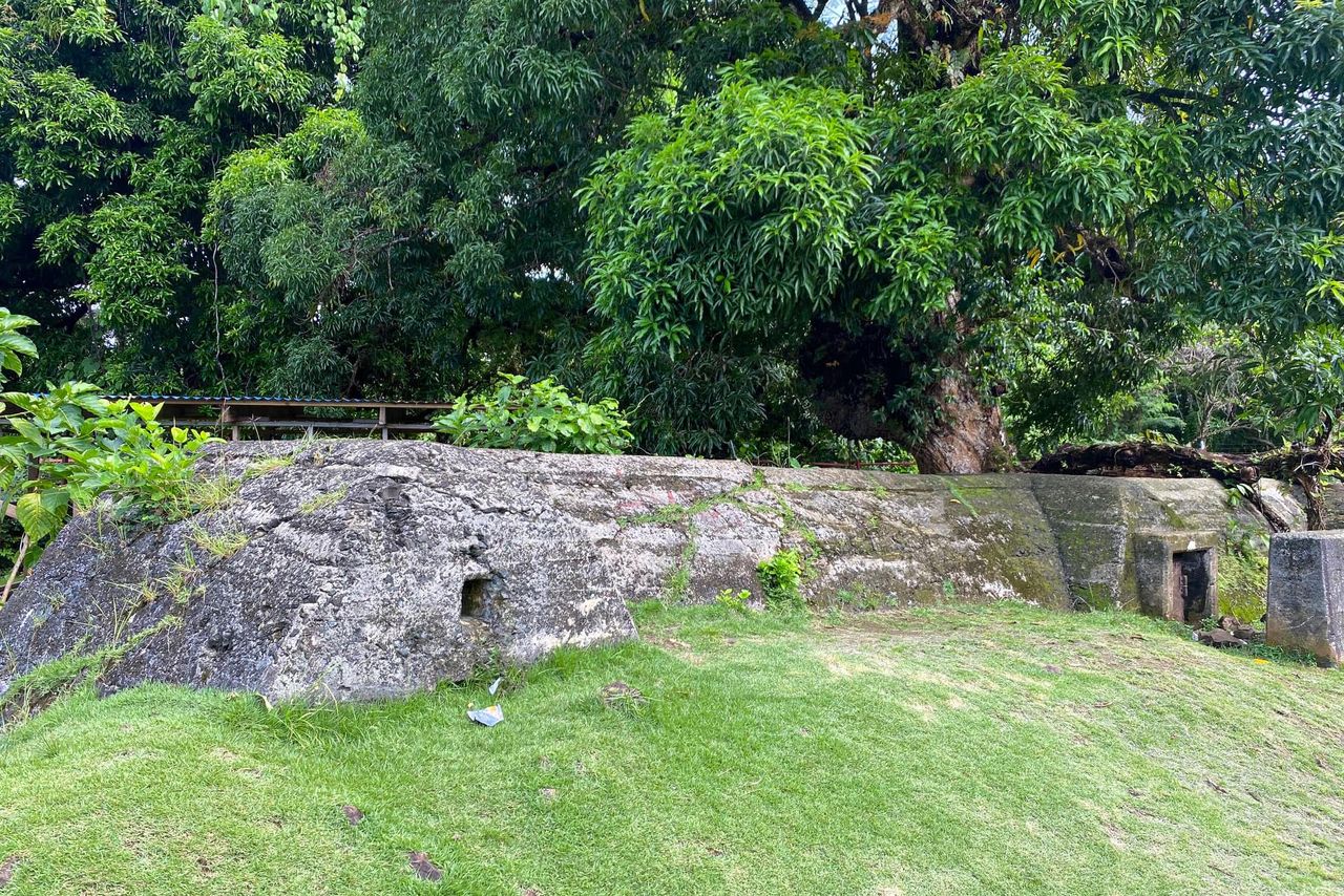
The bunker that housed the communications center in the end days of the war. (© Julian Ryall)
Other interesting locations that can be visited include the steps and foundations of a Shintō shrine, a 12.7-centimeter anti-aircraft battery on the top of Nenengua hill, and the site of the Japanese 4th Fleet Naval Headquarters. A 400-meter causeway over an inlet was called Kuchua Bridge during the occupation years and remains in use by local people.
A two-story building used to be the Formosan Bank, and there are pillboxes, dock facilities, bunkers, and enlarged caves across the island that date from the years the Japanese military were here.
Architectural Remnants of Hard Times
Ishii says local people have “mixed feelings” about the years of the Japanese occupation.
“The Japanese definitely brought many technologies to the islands, such as advanced medical care and education, but also the war itself,” he said. “Individuals’ feelings also depend on how much they were affected or benefited from those experiences.”
And while the early years of Japan’s presence were generally seen as beneficial to local people, the situation became more challenging as World War II went on. Unlike elsewhere in the Pacific, the Allies never attempted a seaborne invasion of Chuuk, but instead bypassed it as they island-hopped across the Pacific to close in on the Japanese main islands.
That meant, however, that it was impossible for Japan to evacuate the military garrison and any remaining civilians, while it was equally impossible to bring in fresh units, equipment, and, most critically, the food and medical supplies that were required to sustain both the military and local Chuukese.
Of the 40,000 Japanese on the islands, historians estimate that more than 5,000 succumbed to starvation and illness, along with 1,000 of the 9,000 Chuukese on the islands at the time.
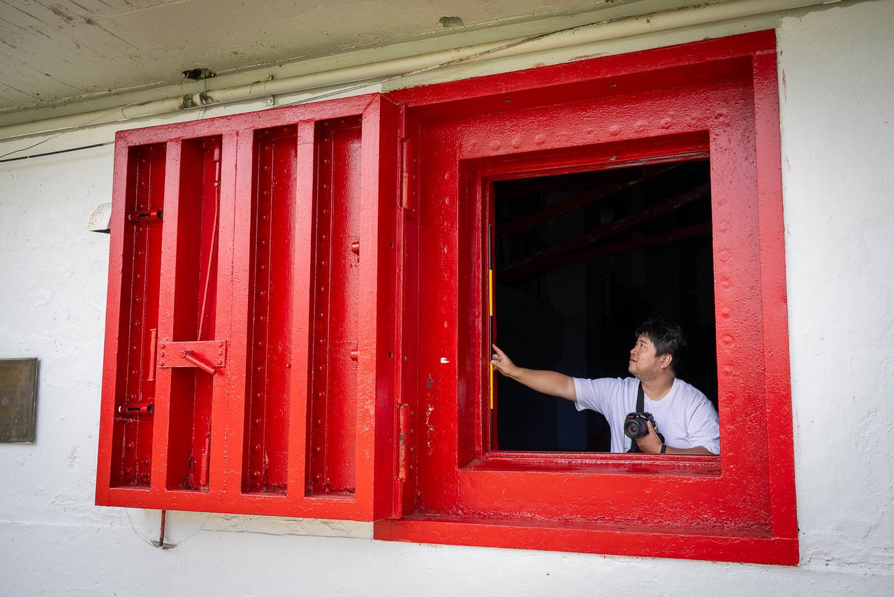
Ishii Hiroshi shows a blast window still in place at Xavier High School, on the main island of Weno. (© Julian Ryall)
Of all the historic sites on Tonoas, Ishii singles out the hospital as his favorite.
“It still retains Taishō and early Shōwa era architectural design elements, which are very rare in Japan nowadays,” he says. “It still holds the elegance of the ‘Taishō Roman’ cultural movement, despite being far away from Japan and in the middle of the jungle.”
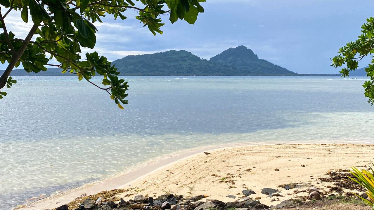
(Originally written in English. Banner photo: A view of the island Tonoas from Weno, to the north. © Julian Ryall.)