Tsunami-Stricken Town Resists “Great Wall” Mentality: Kesennuma’s Quest for a Middle Way
Society- English
- 日本語
- 简体字
- 繁體字
- Français
- Español
- العربية
- Русский
Rush to Build Walls
Kesennuma, a city of about 60,000 in coastal Miyagi Prefecture, is just one of many communities in the Tōhoku region that spent most of the last decade rebuilding from the March 2011 tsunami. But it is the only one that spent seven years debating and negotiating seawalls, notwithstanding a unanimous desire to hasten recovery and reconstruction. One factor was doubtless the area’s deeply indented coastline, requiring far more barriers—at far greater cost—than in any other community. But a more fundamental reason was the citizens’ determination to “live with the sea,” even after the devastation it had caused.
One neighborhood that has come to symbolize Kesennuma’s long ordeal is Kusakizaki at the southern limits of the city, just across the border from Minamisanriku. In May 2015, the municipal government reached an agreement with local stakeholders on a plan for a seawall rising 9.8 meters above sea level along the tiny fishing port of Kurauchi. But serious questions were raised about the need for a ¥1.3 billion structure that would only protect an abandoned field and the bank of a disused train track. The city conducted a review, and in December 2017, the plan was rejected. Meanwhile, a stone’s throw away in Minamisanriku, construction had already been completed on a similar seawall in a virtually identical setting.
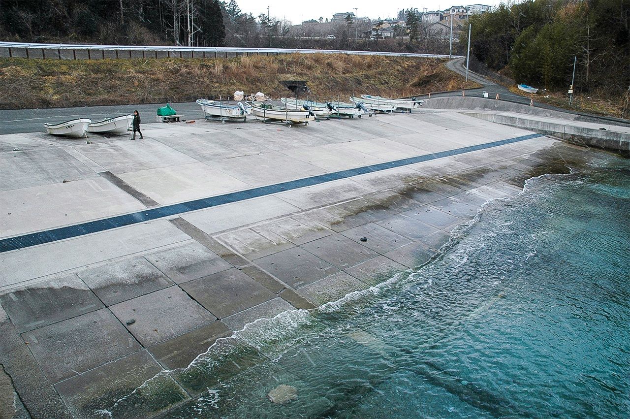
The site of a suspended seawall construction project in Kusakizaki. Behind it runs a dedicated bus route that replaced the badly damaged Kesennuma railway line.
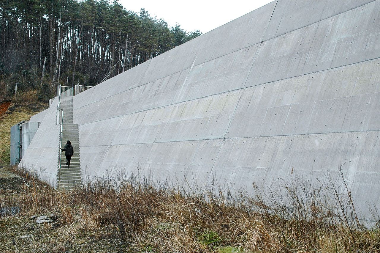
The seawall built next door in Minamisanriku at a cost of ¥450 million yen.
Some background is needed to understand why the debate dragged on so long in Kesennuma.
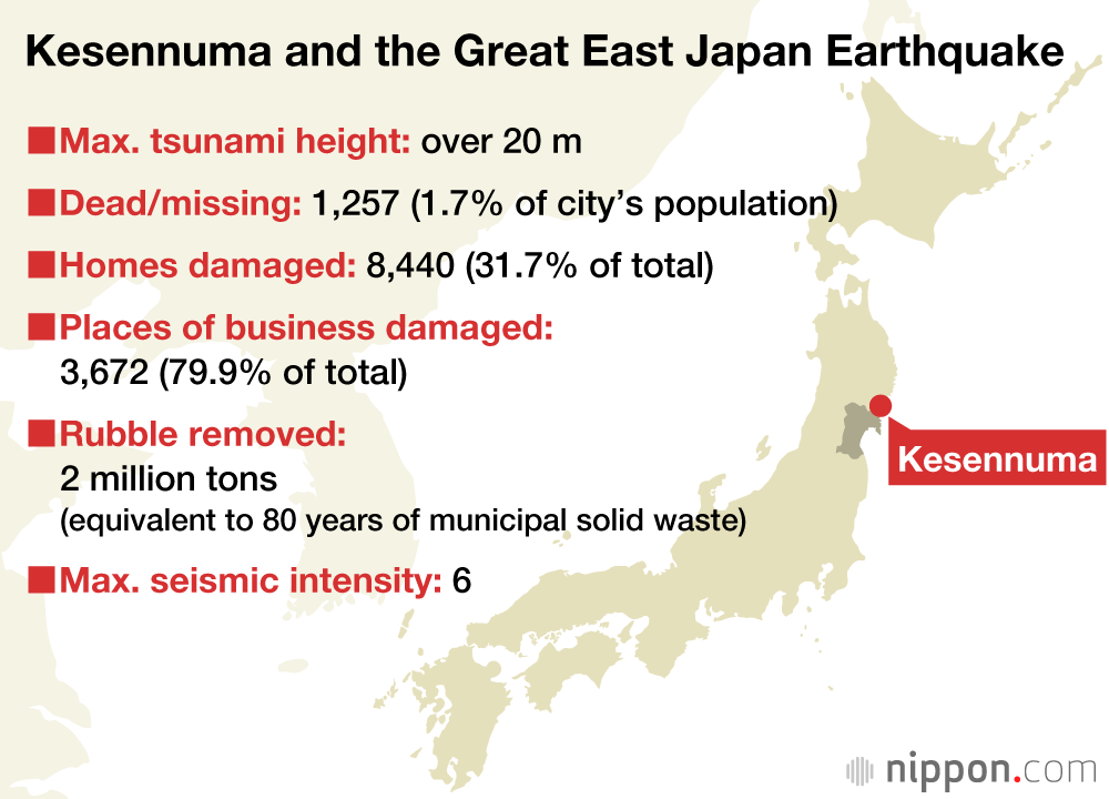
The tsunami triggered by the 2011 Great East Japan Earthquake claimed more than 1,200 lives in Kesennuma and reduced whole neighborhoods to rubble. In the wake of the disaster, the city hammered out a recovery and reconstruction plan geared to ensuring “zero fatalities” from any future tsunami, even if it were to hit in the dead of night. The central government, meanwhile, adopted a coastal protection policy calling for construction of seawalls and breakwaters sufficient to stop a Level 1 tsunami, that is, a wave up to 15 meters (expected to occur roughly every 100–200 years). But the March 2011 disaster was a Level 2 tsunami that reached as high as 25 meters in places. To defend against another once-in-a-millennium event, planners needed to delineate the areas susceptible to inundation even after the construction of Level 1 seawalls and declare them off-limits to housing. Some land would be artificially built up with fill to minimize the tsunami hazard zone and maximize land use. New housing developments would be built on high ground for those whose land fell inside the hazard zone.
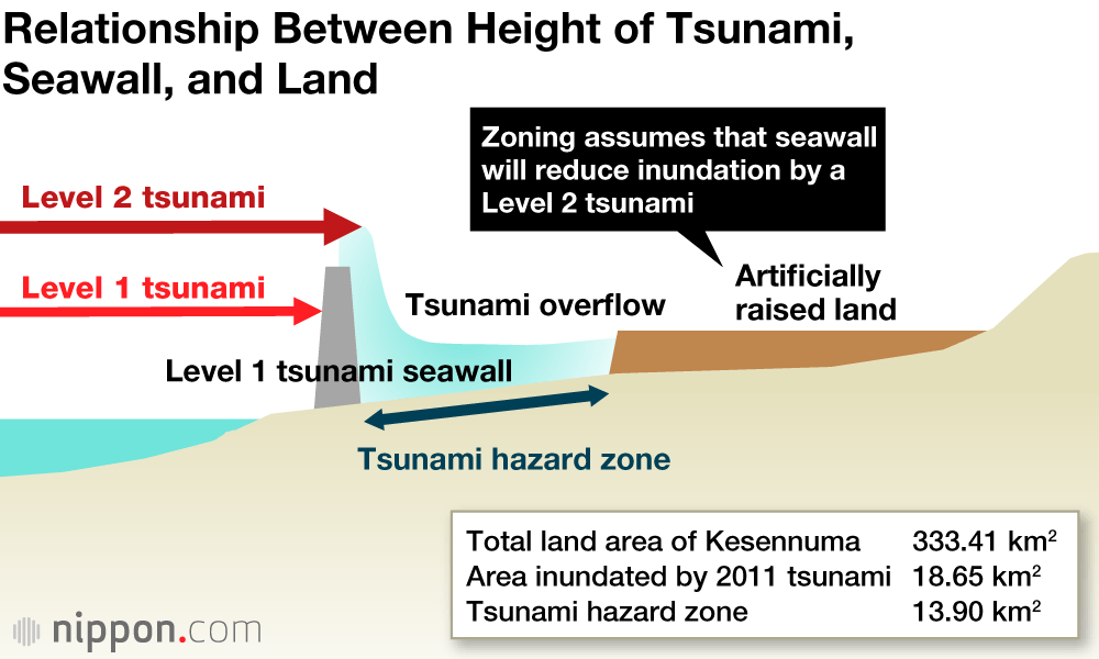
In other words, the city’s entire reconstruction plan hinged on the height and placement of seawalls, which would determine the mapping of the hazard zone and determine which homes needed to be relocated.
Mindful of the need to proceed as quickly as possible, the municipal government launched a blitz of information meetings at locations around the city in the summer of 2011 to present the prefecture’s seawall construction plans to the public. The residents could hardly believe what they were hearing.
Before the 2011 tsunami, most of the seawalls along the coast were 2–4 meters in height, and some stretches of shoreline were barrier-free. The new plan called for seawalls as high as 14.7 meters, and even after they were erected, a full 75% of the area inundated by the 2011 tsunami would be in the hazard zone. Some traumatized residents called for even higher walls, but the majority had the opposite reaction, questioning the point of obliterating the view and the natural seashore with concrete walls that could not prevent a disaster like the one the city had just experienced. There were complaints that the community would “feel like a prison.”
Tears for Koizumi Beach
The Kesennuma reconstruction plan called for a total of 106 seawalls, 72 of which would be higher than the pre-tsunami barriers in the same locations. To secure local stakeholder support for each project, information meetings and discussions were carried out separately in each neighborhood—with widely varying outcomes, as we will see.
In the Koizumi district, the seawall spawned deep divisions that were slow to heal. Under the government’s plan, Koizumi Beach, designated one of Japan’s “top 100 bathing beaches” by the Ministry of the Environment, would become the site of Miyagi Prefecture’s largest seawall: a 14.7-meter barrier connecting with a river dike for a combined length of 4.6 kilometers at an estimated cost of ¥22.3 billion (over $20 million). Given that the people formerly residing in the protected area had all been relocated to higher ground, the plan was criticized as a boondoggle that would wreck the area’s biggest resource, its natural beauty .
Despite the controversy, the prefectural government—which was ultimately in charge of the project—decided that the plan had received the community’s blessing at the information meeting held in November 2013. Outraged citizens protested that the approval process was a sham, circulated petitions, and appealed to the central and prefectural governments to halt the project, attracting the national media’s attention.
Another information meeting was held, but by then business leaders and other influential figures had rallied in favor of the plan, anxious to expedite reconstruction. At a final meeting held in July 2014 to approve the start of construction, a group of high school students submitted an alternate plan and pleaded for further deliberation, saying, “We don’t want the seawall’s protection.” Their entreaties fell on deaf ears. Defeated, the students wept in frustration. “They keep saying it’s for the future,” said one bitterly, “but they won’t even listen to the young people living here.”
The conflict highlighted a stark generational divide between younger residents, who saw the region’s natural beauty as the key to economic revitalization, and its older citizens, who believed in an economic future powered by public works and urbanization. In the absence of meaningful dialogue, the original plan was adopted unaltered. The cost of the seawall and dike, which are nearing completion, has ballooned to ¥49.4 billion.
Just inland, in the vacated area, a large commercial tomato greenhouse has begun operations, and the city is negotiating with a Kamakura beer brewer to build a production facility in the same tract. The beach reopened in 2019. Although some bitterness lingers, most of the community is eager to move on.
Ultimately, the real winners were the stakeholders in other districts. The Koizumi debacle, complete with tearful high school students, spurred a concerted effort to involve the community more closely in the planning process, and that has made a substantial difference to the plans adopted elsewhere in the city.
The completed 14.7-meter seawall at Koizumi Beach.
Applause for Ōshima’s Fishing Port
A different narrative unfolded in Kesennuma Ōshima, the Tōhoku region’s largest inhabited island. Styled the “green pearl” for its natural beauty and charm, the island has a thriving community that was thrown into turmoil by the seawall plan formulated by the prefecture.
The islanders were overwhelmingly skeptical of the “great wall” approach to tsunami defense. They prevailed on the prefecture to scrap the 11.8-meter wall planned for one of the beaches and to build a wooded embankment instead of a wall on a neighboring beach.
However, the two sides deadlocked on plans for a 7.8-meter seawall along the fishing port of Uranohama, the island’s gateway to the sea. The residents insisted that the wall was too high; the prefecture said it needed compelling reasons to alter the plan. The standoff continued through successive information meetings, where the local official in charge endured scathing attacks as residents accused the prefecture of acting unilaterally, without regard for the people who had to live there.
What broke the deadlock was the creation of a community reconstruction roundtable, where designated representatives of community stakeholder groups were able to sit down with local officials in an atmosphere of collaboration instead of confrontation. In a series of meetings, participants grappled with the issues one by one, from the basic need for a seawall to the effect of various alterations. Detailed minutes were kept to keep the deliberations moving forward.
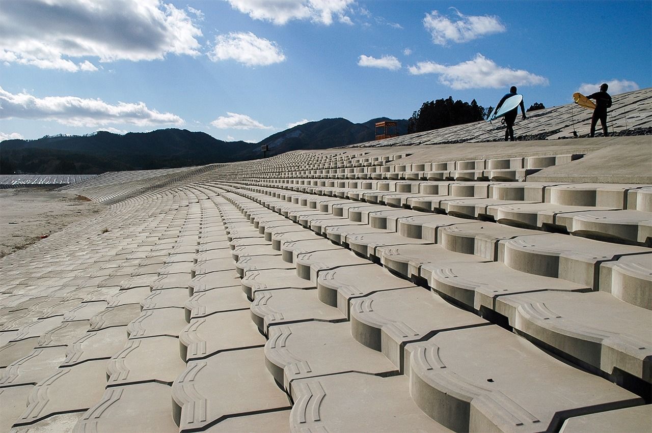
From this process, an alternative plan emerged. The height of the seawall would be 7.5 meters, 30 centimeters lower than the original design, and it would be built 30 meters back from the water’s edge. On the bay side, the wall would be covered with earth and planted with vegetation. The land behind the seawall would be filled to the same height as the wall, and the city would build a visitors’ complex on that site.
At the final public information meeting on the project, held in July 2017, residents rose at the end of the session to express their thanks, and the hall reverberated with applause.
From such cases, local officials came to appreciate the need to approach community planning collaboratively. By sharing accurate information in language everyone could understand, listening to one another’s views, and sitting down together to discuss solutions, we were able to move forward one step at a time.
The fishing port of Uranohama, Ōshima, in the final stages of redevelopment. The cement seawall is being covered with earth and will be planted with vegetation.
Creative Reconstruction of the Inner Harbor
In one district after another, the prefecture’s seawall plans were sent back for modification at the community’s request. Some barriers were moved inland to preserve the natural seashore. Some were made to double as elevated highways. Others were equipped with acrylic windows to mitigate the oppressive effect of a solid wall. None of the proposed changes were accepted initially, but through patient dialogue, we were able to get it done.
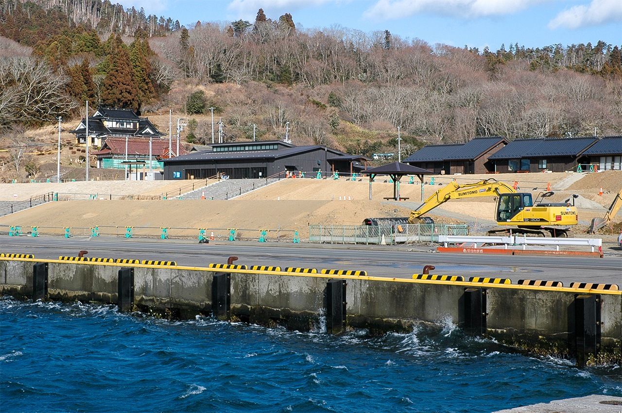
Kesennuma’s Naiwan district, the city’s commercial center, epitomizes this process. This inner harbor area developed simultaneously as a fishing port—with a major fish market nearby—and a shopping and entertainment district, bringing together a lively mix of residents, fishermen, and tourists. The inner harbor was also the terminal for the Ōshima-Kesennuma ferry, which provided a steady flow of traffic in the neighborhood. However, the construction of a bridge across the narrow strait between Ōshima and Kesennuma (completed in April 2019) augured the end of regular ferry service. That, together with the relocation of residents to high ground farther inland, threatened the vitality of the Naiwan district. Alarmed, local stakeholders joined forces in a push for “creative reconstruction.”
Before the March 2011 disaster, there had been no seawalls separating the Naiwan district from the water; the port and the sea were one. Committed to preserving their district’s view of the bay, local stakeholders rejected the prefecture’s plan for a 6.2-meter concrete wall around the inner harbor. The city solicited reconstruction ideas from around the world and commissioned additional simulations to determine the effect of such measures as a floating breakwater. Intensive deliberations continued for three years.
New simulations established that the seawall’s height could be lowered to 5.1 meters, including the 1-meter safety margin mandated by the prefecture. Unfortunately, that meant the wall would still be 2 meters higher than the filled land behind it, blocking the sea from view. The solution to which the prefecture eventually agreed involved building a 4.1-meter wall with 1-meter flap gates that would lie flat unless pushed up by the pressure of rising water during a tsunami. It was the first time this mechanism had ever been used for a coastal protection structure in Japan. Construction would cost considerably more than a solid concrete wall, but it would preserve Naiwan’s view of the ocean.
Elsewhere along the inner harbor, a 5-meter seawall would be integrated into the waterfront townscape. Restaurants, cafes, walkways, and other public facilities designed to ensure an abundance of ocean views would be built atop and along the structure. A less heavily developed section of shoreline, where the risk to human life and property was deemed minimal, would be left wall-free at the request of the local stakeholders, who were firmly united behind the plan.
The application of three different solutions within a space of about 500 meters makes the Naiwan reconstruction plan unique in the region. As a result, the district has become a popular topic of study among researchers and students in such fields as architecture, civil engineering, and disaster prevention.
To be sure, cities and towns that spent less time agonizing over seawalls may have completed their reconstruction projects faster. But the focus on seawalls helped to raise the public’s awareness of the trade-offs involved in reconstruction and disaster prevention. United behind a shared determination to continue “living with the sea,” Kesennuma’s citizens and city leaders joined hands, marched forward unflaggingly, and made a real difference in the community.
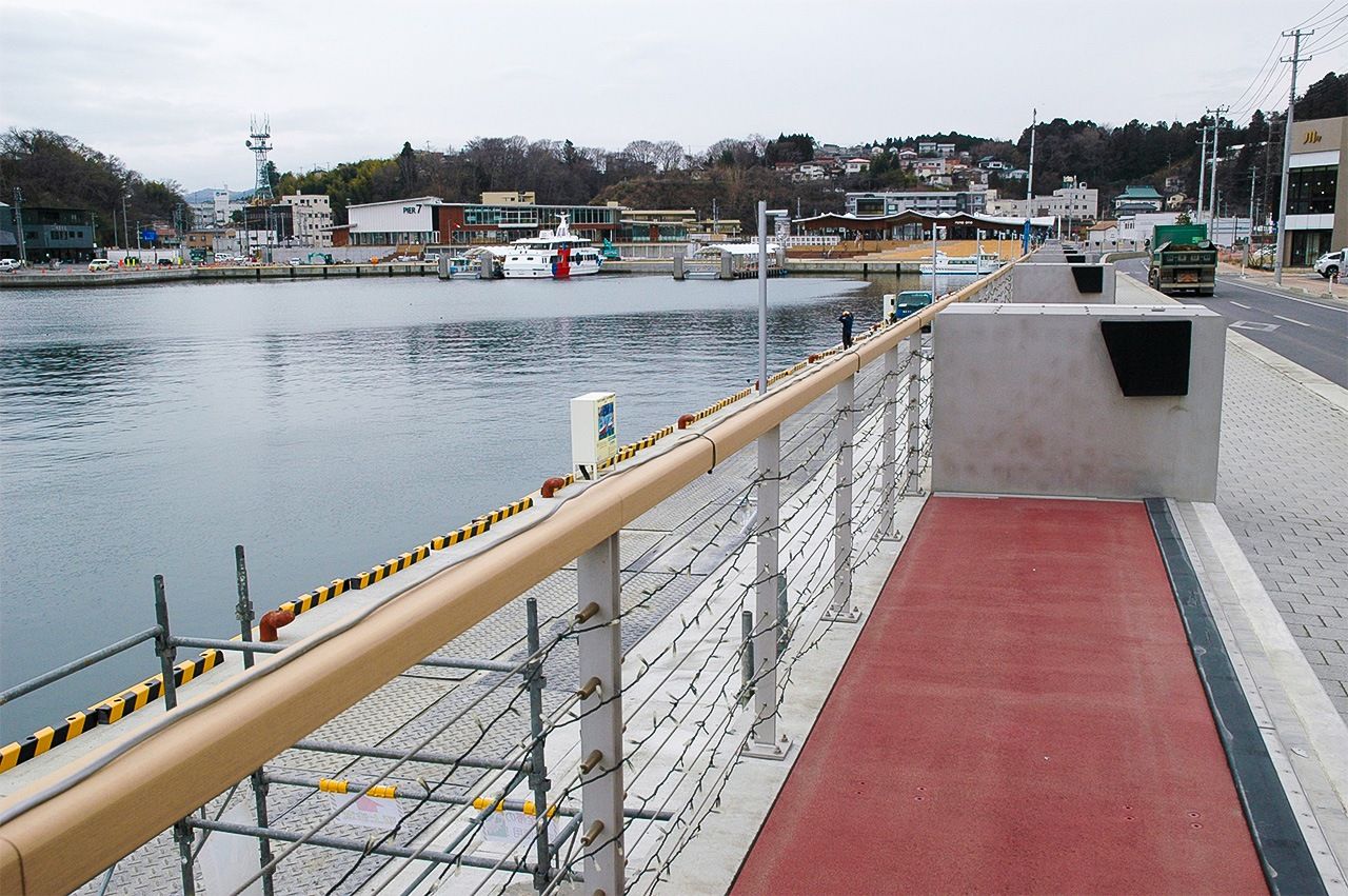
The flap gates of the inner harbor’s innovative seawall can be seen in red. Beyond lies the Naiwan district, the centerpiece of Kesennuma’s “creative reconstruction” plan.
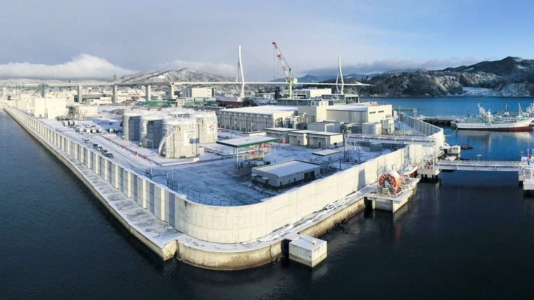
(Originally written in Japanese. Banner photo: An oil refinery and shipbuilding facility operate behind a 7.2-meter seawall in Kesennuma, Miyagi Prefecture, symbols of the region’s post-tsunami redevelopment. © Kyōdō.)
disaster tsunami Great East Japan Earthquake recovery Kesennuma