A Month with More than 2,000 Earthquakes in Japan’s Southern Tokara Islands
Disaster Society- English
- 日本語
- 简体字
- 繁體字
- Français
- Español
- العربية
- Русский
Continued Seismic Activity
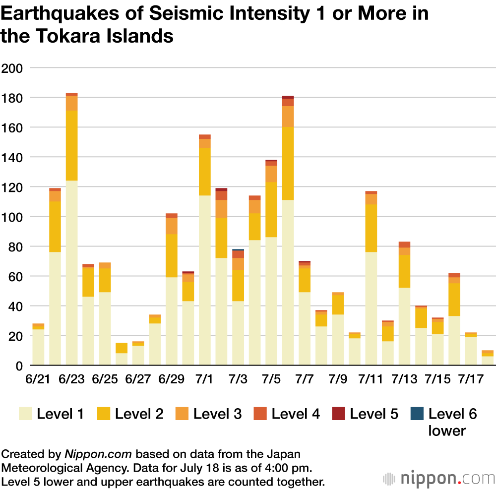
More than 2,000 earthquakes have rocked the Tokara Islands in Kagoshima Prefecture since June 21, in a continued period of seismic activity. From June 21 through the afternoon of July 18, there were 2,171 earthquakes with a seismic intensity of 1 or more.
July 3 saw the largest tremors, including one of level 6 lower on the seismic intensity scale recorded among a series of quakes from 4:13 in the afternoon on the island of Akusekijima.
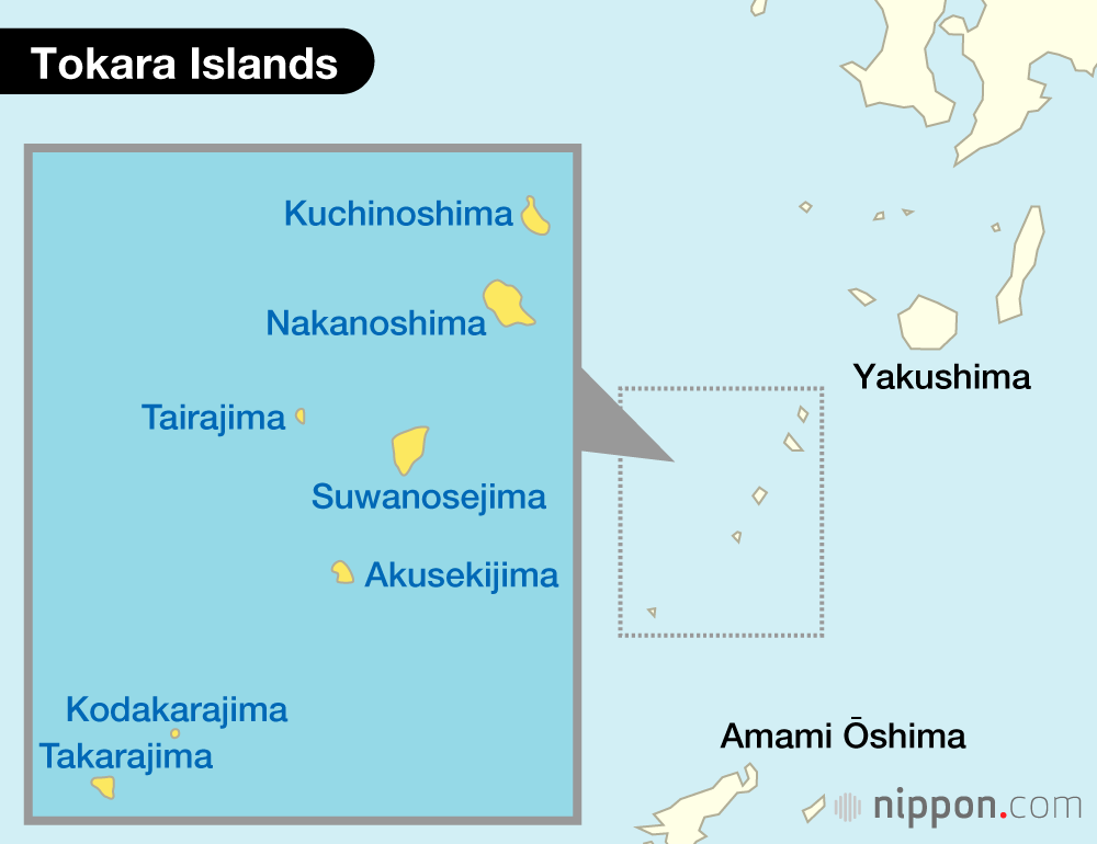
The Tokara Islands lie between Yakushima and Amami Ōshima in the waters south of mainland Kagoshima Prefecture. The seven inhabited and five uninhabited islands are administratively part of the village of Toshima.
Kyūshū and the Tokara Islands are located where the Philippine Sea Plate is subducted under the Eurasian Plate, leading to considerable seismic activity in the area. In December 2021, there were 308 earthquakes of seismic intensity 1 or more (maximum 5 upper), and in September 2023, there were 346 (maximum 4). However, there have been far more earthquakes this time.
Three groups of residents have evacuated from Akusekijima to the city of Kagoshima and elsewhere, but the stress of living as an evacuee and concern over family members remaining on the island have led some to return. While the number of earthquakes has slightly declined since July 14, the JMA warns residents to stay alert for tremors with a seismic intensity up to level 6 lower.
Data Sources
- Earthquake data (Japanese) from Fukuoka District Meteorological Observatory.
- Data on earthquakes’ seismic intensity (Japanese) from Fukuoka District Meteorological Observatory.
- Earthquake data from Japan Meteorological Agency.
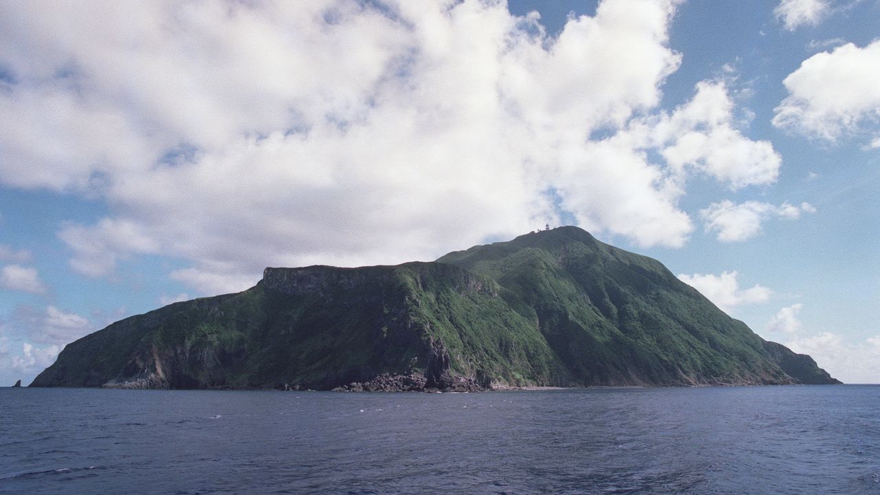
(Translated from Japanese. Banner photo: Akusekijima in the Tokara Islands. © Pixta.)