
Plate Boundary Stress Makes Earthquakes off Northern Japan a Regular Occurrence
Disaster Society- English
- 日本語
- 简体字
- 繁體字
- Français
- Español
- العربية
- Русский
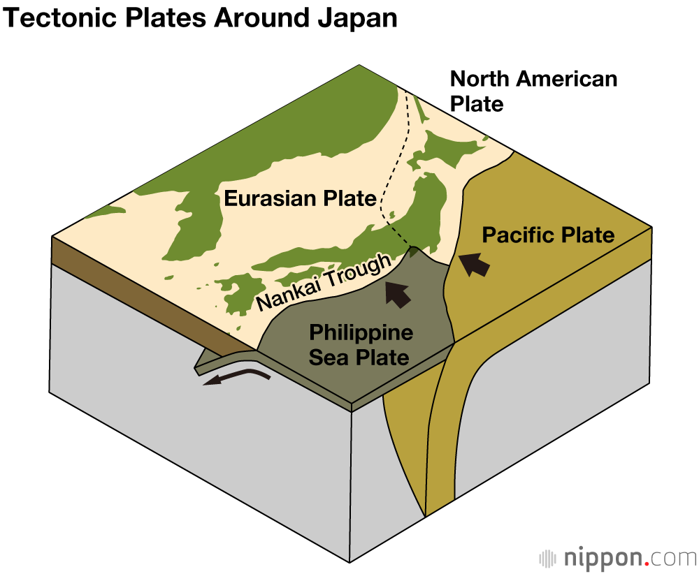
From southern Hokkaidō to around the Japan Trench off Fukushima Prefecture, the Pacific Plate pushes under the edge of the North American Plate. Accumulated stress along the plate boundary is released in the form of regular major earthquakes.
The Great East Japan Earthquake on March 11, 2011, had Japan’s highest ever recorded magnitude of 9.0. This event caused devastating tsunamis along the country’s Pacific coast, and resulted in a total of 22,332 fatalities or missing persons (including indirect disaster-related deaths) in 12 prefectures.
The 1896 Meiji Sanriku Earthquake (magnitude 8.5) triggered tsunamis from Hokkaidō to northern Miyagi, leading to 21,959 fatalities, with more than 10,000 homes washed away or destroyed. In 1933, the Shōwa Sanriku Earthquake (magnitude 8.1) caused severe tsunami damage along the Sanriku coast of northeastern Honshū, with 3,064 people killed or missing and almost 10,000 homes washed away, destroyed, or flooded.
The map below shows the hypocenters of earthquakes with a magnitude of 7 or greater since 1896. Records show that there were also major disasters before that time, such as those in 869, 1611, and 1793.
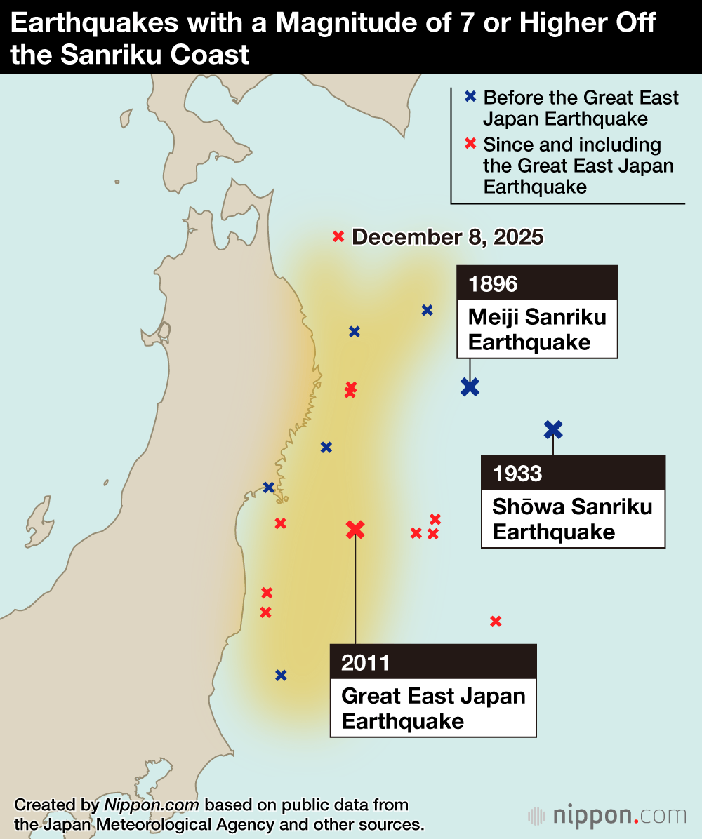
| Meiji Sanriku Earthquake (8.5) | June 15, 1896 |
| Off northern Sanriku (7.4) | August 9, 1901 |
| Shōwa Sanriku Earthquake (8.1) | March 3, 1933 |
| Off eastern Fukushima (7.5) | November 5, 1938 |
| Off Tokachi (7.9) | May 16, 1968 |
| Off Miyagi (7.4) | June 12, 1978 |
| Far offshore from Sanriku (7.6) | December 28, 1994 |
| Off Miyagi (7.1) | May 26, 2003 |
| Great East Japan Earthquake foreshock (7.3) | March 9, 2011 |
| Great East Japan Earthquake foreshock (7.4) | March 11, 2011 |
| Great East Japan Earthquake foreshock (7.5) | March 11, 2011 |
| Great East Japan Earthquake (9.0) | March 11, 2011 |
| Off Miyagi (7.1) | April 7, 2011 |
| Off Sanriku (7.0) | July 10, 2011 |
| Off Sanriku (7.3) | December 7, 2012 |
| Off Fukushima (7.1) | October 26, 2013 |
| Off Fukushima (7.4) | November 22, 2016 |
| Off Fukushima (7.4) | March 16, 2022 |
| Off eastern Aomori (7.6) | December 8, 2025 |
Data Sources
- Data on earthquakes around the Japan Trench and Kuril Trench (Japanese) from the Japan Meteorological Agency.
- Data on earthquakes in Japan (Japanese) from the Japan Meteorological Agency.
- Data on earthquakes since 1868 (Japanese) from the Geospatial Information Authority of Japan.
(Translated from Japanese. Banner photo: Tsunami damage caused by the March 2011 Great East Japan Earthquake. Photograph taken in Yamada, Iwate, on April 19, 2011. © Institute of Scientific Approaches for Fire & Disaster.)