Japan’s Minamitorishima Island: Potential Site for Mining Rare Earths and Storing Nuclear Waste
Society Politics- English
- 日本語
- 简体字
- 繁體字
- Français
- Español
- العربية
- Русский
A Remote Location
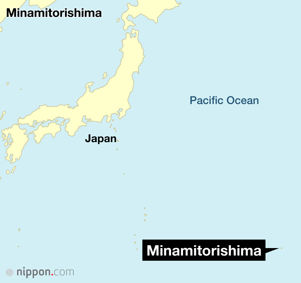
Minamitorishima is Japan’s easternmost island and belongs to the municipality of Ogasawara, which oversees a number of Pacific islands and is administratively part of the Tokyo metropolis. The island is located about 1,950 kilometers southeast of the city of Tokyo, from which it can be reached in about four hours by plane. It is extremely remote, and is separated from Ogasawara’s inhabited islands Chichijima and Hahajima by a distance of roughly 1,200 kilometers.
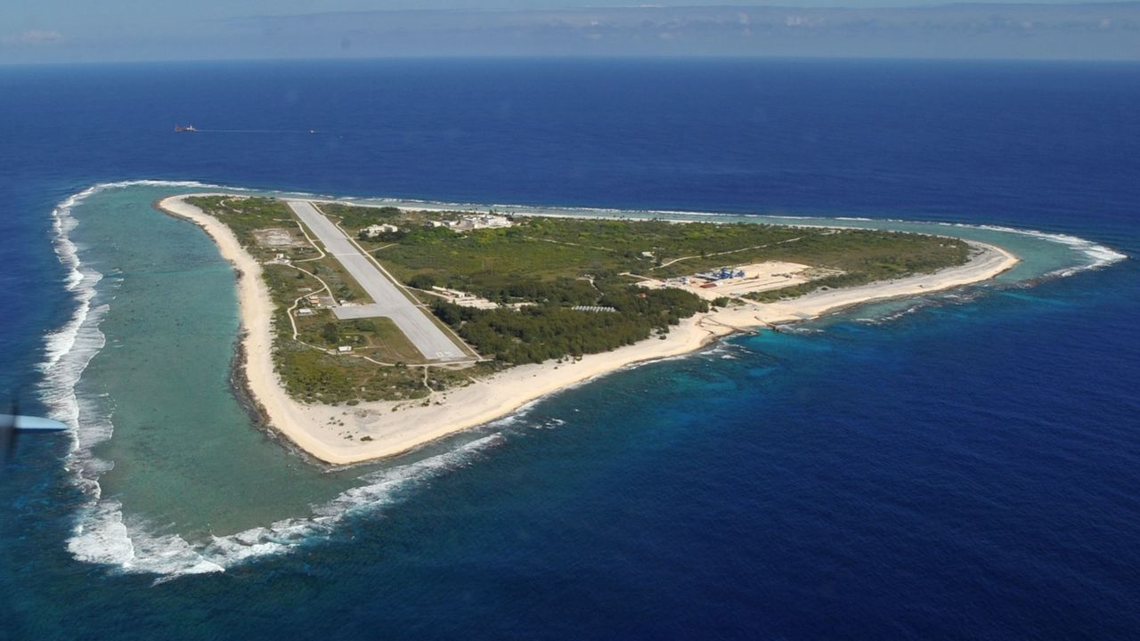
Although historical accounts differ, the island is thought to have been discovered during the Age of Exploration in 1543 by the Spaniard Bernardo de la Torre. The first recorded landing by Japanese people was in 1883. In 1898, it was given the name Minamitorishima and incorporated into administration by Tokyo, along with the Ogasawara Islands. At one time coconut oil and guano were produced on the island, but supplying production materials to this remote location proved extremely difficult. This problem, combined with severe weather conditions such as rising tides as well as infectious diseases, led to the island becoming uninhabited in 1935. Although there are still no civilian residents today, the island has a runway and wharf, and personnel from Japan’s Ministry of Defense and the Japan Meteorological Agency are stationed there.
Minamitorishima is the exposed summit of an undersea mountain formed by volcanic activity spanning from roughly 100 million years ago to several tens of millions of years ago. The shape of the island is similar to an equilateral triangle, with sides of about 2 kilometers, and it is surrounded by coral reefs. The submerged mountain rises about 5,000 meters from the seafloor, with a base diameter of around 50 kilometers, forming roughly the same area as the Tokyo metropolitan region.
Because the Japanese archipelago lies along the boundaries of four tectonic plates, it has been struck many times throughout history by major earthquakes. However, Minamitorishima, located far to the southeast of the main islands, is on the Pacific Plate, and is distant from any plate boundaries with no notable active faults. For that reason, it is considered to rest on the most stable bedrock located within Japanese territory.

Recent Developments on Minamitorishima
- June 2012: A research team from the University of Tokyo and other institutions discovers rare earth deposits on the seabed around Minamitorishima.
- August 2016: A research team with members from institutions including the Japan Agency for Marine-Earth Science and Technology, Chiba Institute of Technology, and the University of Tokyo finds dense concentrations of spherical rocks containing rare metals, known as manganese nodules, on the deep seafloor southeast of Minamitorishima.
- February 2026: JAMSTEC’s research vessel Chikyū successfully recovers mud containing rare earth elements from the seafloor at a depth of about 5,700 meters off Minamitorishima.
- March 2026: Japan’s Ministry of Economy, Trade, and Industry asks the municipality of Ogasawara, Tokyo, to conduct a preliminary document survey for Minamitorishima as a possible final disposal site for highly radioactive waste generated by nuclear power plants.
Data Sources
- Data on Minamitorishima (Japanese) from Tokyo Metropolitan Government Bureau of General Affairs
- Data on the geology of Okinotorishima and Minamitorishima (Japanese) from Sasakawa Peace Foundation
- Data on the history of the formation of Minamitorishima (Japanese) from Tōhoku University
(Translated from Japanese. Banner photo: An aerial view of Japan’s easternmost island Minamitorishima. Photograph taken on November 21, 2012. © Jiji.)