Mount Akita-Komagatake: An Easy Climb Offering Splendid Views
JapanIn video
Guide to Japan Travel Lifestyle- English
- 日本語
- 简体字
- 繁體字
- Français
- Español
- العربية
- Русский
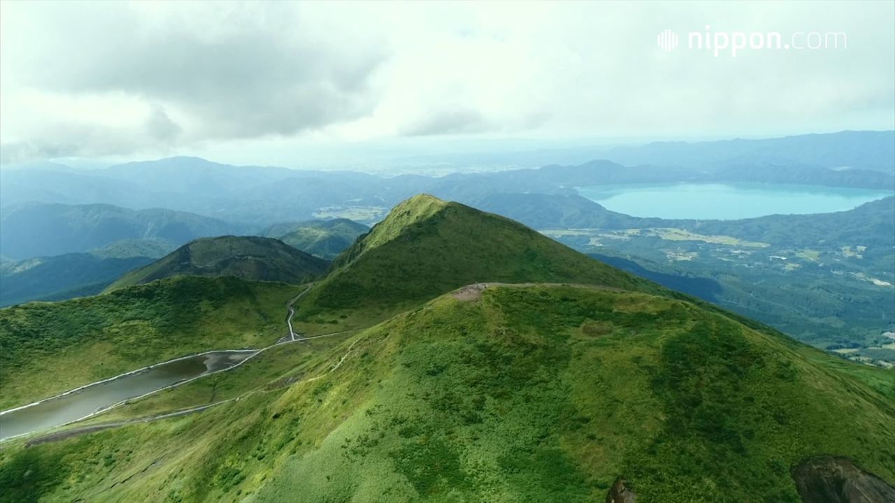
Though its maximum elevation is a modest 1,637 meters, Mount Akita-Komagatake is the highest mountain in Akita Prefecture. It is known for the wealth of alpine plants on its slopes. And those who climb to the main peak are treated to a spectacular panorama. To the west lies ultramarine-colored Lake Tazawa. To the south is Mount Chōkai, with a shape reminiscent of Mount Fuji, straddling the Akita-Yamagata prefectural border. And Mount Iwate, the highest mountain in Iwate Prefecture, rises to the east. On the way to the top, visitors can enjoy the soothing sight of Amida Pond. Nearby is the splendid scenery of a location that has been dubbed as “Moomin Valley.” Another attraction in the area of this mountain is Akita’s Nyūtō Onsenkyō, a collection of hot spring inns nestled in a forest.
Mount Akita-Komagatake is easy to climb. A roadway leads to the visitors’ entrance to the mountain paths, located at Station 8 (one of the 10 stations punctuating the route from the base to the summit), though during the busy summer season passenger cars are excluded and access is by bus. Note that this is an active volcano, and emissions of gas are to be seen in the vicinity of Medake, one of the secondary peaks. Travelers should check in advance for reports of unusual volcanic activity.
(Originally published in Japanese. Created in cooperation with Cable Networks Akita.)